Latitude: 50.9524 / 50°57'8"N
Longitude: 0.9066 / 0°54'23"E
OS Eastings: 604244
OS Northings: 121014
OS Grid: TR042210
Mapcode National: GBR T0L.804
Mapcode Global: FRA D6SL.H0B
Plus Code: 9F22XW24+WJ
Entry Name: The Grange
Listing Date: 28 November 1950
Last Amended: 30 January 1973
Grade: II
Source: Historic England
Source ID: 1122653
English Heritage Legacy ID: 175208
ID on this website: 101122653
Location: Lydd, Folkestone and Hythe, Kent, TN29
County: Kent
District: Folkestone and Hythe
Civil Parish: Lydd
Built-Up Area: Lydd
Traditional County: Kent
Lieutenancy Area (Ceremonial County): Kent
Tagged with: Building
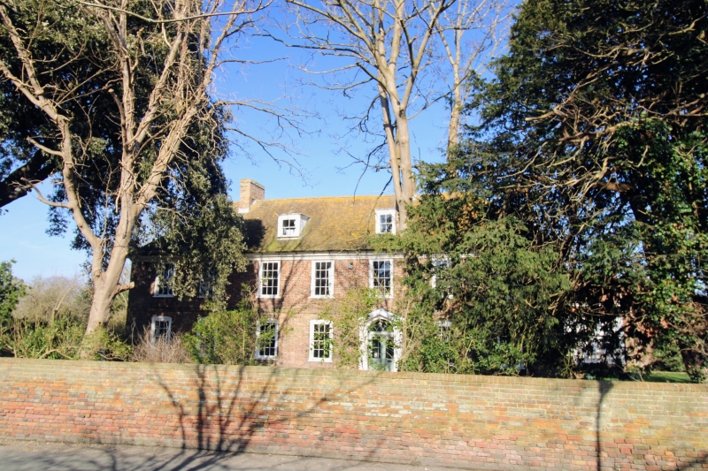
DENNE'S LANE 1. 1355 The Grange (Formerly listed under High Street TR 0421 SW 3/22 28.11.50. II 2. A large C18 house of 2 parallel ranges. 2 storeys and attic red brick and grey headers. Tiled roof with 2 dormers and dentilled wooden eaves cornice. Stringcourse. 7 sashes with glazing bars intact on the 1st floor only. The ground floor windows have cambered head linings. Doorcase in centre of front with pilasters with paterae above, pediment and semi-circular tympanum with decorative glazing bars.
Listing NGR: TR0424721016
External links are from the relevant listing authority and, where applicable, Wikidata. Wikidata IDs may be related buildings as well as this specific building. If you want to add or update a link, you will need to do so by editing the Wikidata entry.


Other nearby listed buildings