Latitude: 54.7744 / 54°46'27"N
Longitude: -1.5803 / 1°34'49"W
OS Eastings: 427096
OS Northings: 542241
OS Grid: NZ270422
Mapcode National: GBR KFD7.N9
Mapcode Global: WHC4Q.P8P7
Plus Code: 9C6WQCF9+PV
Entry Name: 50, South Street
Listing Date: 10 March 1988
Grade: II
Source: Historic England
Source ID: 1121340
English Heritage Legacy ID: 110512
ID on this website: 101121340
Location: Durham, County Durham, DH1
County: County Durham
Electoral Ward/Division: Elvet and Gilesgate
Parish: City of Durham
Built-Up Area: Durham
Traditional County: Durham
Lieutenancy Area (Ceremonial County): County Durham
Church of England Parish: Durham St Margaret of Antioch
Church of England Diocese: Durham
Tagged with: Building
DURHAM AND FRAMWELLGATE SOUTH STREET NZ 2742 SE (West side)
14/454 No. 50
GV II
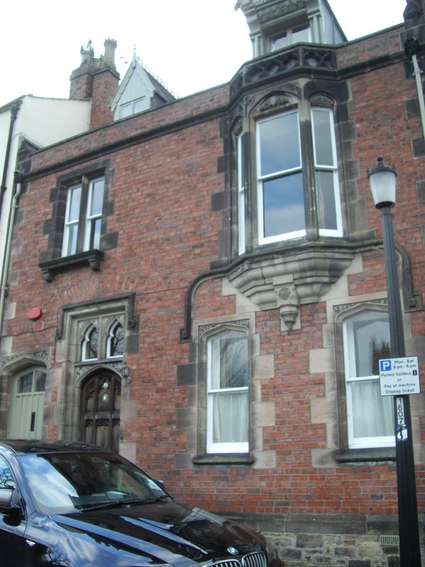
House. Dated 1859. English garden wall bond brick with snecked sandstone plinth and ashlar quoins and dressings; graduated Lakeland slate roof with yellow terracotta crestings. Tudor style. 2 storeys and attics; 2 bays. Ledged boarded partly-glazed door at left in chamfered Tudor-arched surround; 4-centred arch to right of that contains 9-panelled door, with Gothic tracery and 2 cusped lights above, in moulded surround with tongue-stopped chamfer and hexagonal stops to label mould. Carved spandrels to doors and to paired sashes at right in irregular alternate-block jambs, sloping sills and carved Tudor heads. Oriel above, dated 1859 on stone bracket, has pierced quatrefoil balustrade. Sill string curves down to square stops flanking window heads. Narrow paired sashes above door have chamfered alternate-block surrounds and prominent bracketed sills. Continuous eaves string with animal-head stops. Brick parapet has sloped stone coping terminating in gablets with fleur-de-lis finials. Steeply-pitched roofs of gabled dormers have patterned bargeboards, that at right flanked by shafts supporting vine-carved cornice. Roof has fleur-de-lis crestings; single left front ridge chimney with castellated yellow octagonal pot; quoins to right chimney; both with sloped copings.
Listing NGR: NZ2709642241
External links are from the relevant listing authority and, where applicable, Wikidata. Wikidata IDs may be related buildings as well as this specific building. If you want to add or update a link, you will need to do so by editing the Wikidata entry.


Other nearby listed buildings