Latitude: 54.593 / 54°35'34"N
Longitude: -1.3152 / 1°18'54"W
OS Eastings: 444349
OS Northings: 522189
OS Grid: NZ443221
Mapcode National: GBR MH8B.2B
Mapcode Global: WHD6R.RTXB
Plus Code: 9C6WHMVM+5W
Entry Name: The Hermitage
Listing Date: 19 January 1951
Grade: II
Source: Historic England
Source ID: 1121124
English Heritage Legacy ID: 59352
ID on this website: 101121124
Location: Norton, Stockton-on-Tees, North Yorkshire, TS20
County: Stockton-on-Tees
Electoral Ward/Division: Norton North
Parish: Non Civil Parish
Built-Up Area: Stockton-on-Tees
Traditional County: Durham
Lieutenancy Area (Ceremonial County): County Durham
Church of England Parish: Norton St Mary the Virgin
Church of England Diocese: Durham
Tagged with: Building
NZ 4422 SW NORTON THE GREEN (North side) HIGH ROW
20/186
19.1.51 No 28 (The Hermitage)
GV II
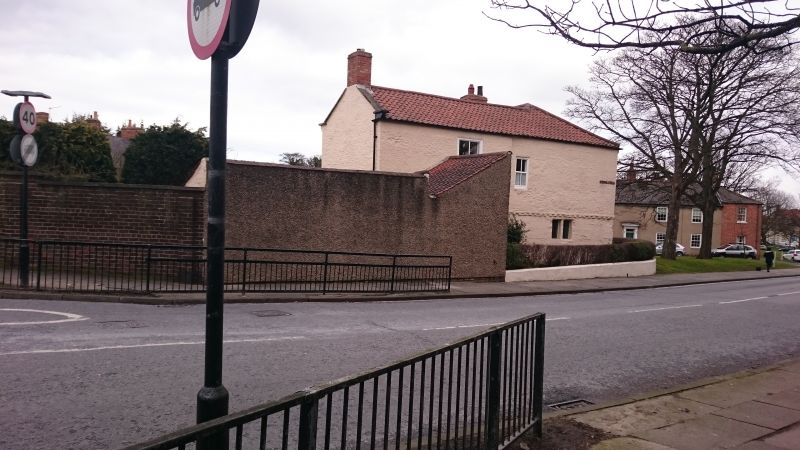
Formerly the Grammar School and facing the old line of Mill Lane. Now forms a long-stop on the North-West corner of the Green. Reputedly of mediaeval origins, supposedly a residence for the canons of St Mary's Church which was collegiate. Fine vaulted collar anyway, even if the ground floor is probably C17. Mostly C18 and early C19. Two storeys and 3 windows with a tall single storey later 3-window schoolroom wing. Ground floor of main building is ashlar, roughcast above, covering the brick modillion cornice above ground floor. Later glazed sash windows; glazing bars in wing. West gable end has blocked mullion window. Pantiled roof, hipped to West; large central stack. School room wing has fall hipped pantiled roof. Two storey, one-window extension to North, gabled and with kneelers.
Listing NGR: NZ4434722189
External links are from the relevant listing authority and, where applicable, Wikidata. Wikidata IDs may be related buildings as well as this specific building. If you want to add or update a link, you will need to do so by editing the Wikidata entry.


Other nearby listed buildings