Latitude: 54.5653 / 54°33'55"N
Longitude: -1.7245 / 1°43'28"W
OS Eastings: 417912
OS Northings: 518934
OS Grid: NZ179189
Mapcode National: GBR JHDN.G7
Mapcode Global: WHC5M.HJ10
Plus Code: 9C6WH78G+46
Entry Name: Pack-Horse Bridge
Listing Date: 14 September 1966
Grade: II
Source: Historic England
Source ID: 1121080
English Heritage Legacy ID: 111092
ID on this website: 101121080
Location: Headlam, County Durham, DL2
County: County Durham
Civil Parish: Headlam
Traditional County: Durham
Lieutenancy Area (Ceremonial County): County Durham
Church of England Parish: Gainford
Church of England Diocese: Durham
NZ 11 NE 179189
6/8
14/9/66
HEADLAM
THE GREEN
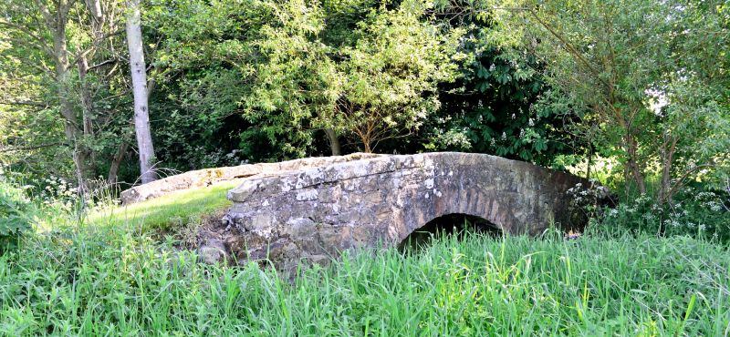
Pack-horse bridge
II
Pack-horse bridge. Probably c18. Dressed sandstone faces and tunnel.
Single segmental arch, defined by large voussoirs, supports raised central
section with low, raking pathway to either end. Low parapet, partly ruinous
at north-east corner at time of survey.
Scheduled Ancient Monument
Listing NGR: NZ1791218934


Other nearby listed buildings