Latitude: 50.6928 / 50°41'34"N
Longitude: -2.1152 / 2°6'54"W
OS Eastings: 391955
OS Northings: 88135
OS Grid: SY919881
Mapcode National: GBR 32T.D1M
Mapcode Global: FRA 67G7.V1G
Plus Code: 9C2VMVVM+4W
Entry Name: Wareham Railway Station
Listing Date: 8 April 1976
Grade: II
Source: Historic England
Source ID: 1119995
English Heritage Legacy ID: 108027
Also known as: Wareham Station
WRM
ID on this website: 101119995
Location: Wareham, Dorset, BH20
County: Dorset
Civil Parish: Wareham Town
Built-Up Area: Wareham
Traditional County: Dorset
Lieutenancy Area (Ceremonial County): Dorset
Church of England Parish: Wareham Lady St Mary
Church of England Diocese: Salisbury
Tagged with: Railway station
1. 5190 NORTHPORT (West Side)
Wareham Railway Station SY 9188 3/171
II
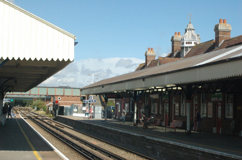
2. 1886. Built by London and South Western Railway when the Wareham-swanage branch was opened. The original Southampton and Dorchester Railway station had been further east, but was moved to the present site in 1864. Red brick with ashlar dressings. Pitched tile roof. Red brick stacks with ashlar coping. 1 storey with attics. 2 coped gables with finials and kneelers; that to east shaped, topped with pediment, and with 3 pilasters taking cornice half way up; that to west has stone mullioned window, with full entablature and pediment over central part. Between gables is 1 attic dormer with pargetted front, pitched roof and casements. 2 one-storey extensions with coved eaves cornices at either end. Centre of roof ridge crowned by octagonal turret, with ogival lead roof and weather-vane. Casement windows on yard side. Sashes on platform side. Platform shelters taken on cast iron columns of eclectic design with ornamental cast iron spandrels which support roof trusses. Pitched corrugated iron roofs with cut wooden valances. Weatherboard and panelled shelters with contemporary benches on up platform. Elaborate columns gas standards on both platforms east and west of shelters.
Listing NGR: SY9195588135
External links are from the relevant listing authority and, where applicable, Wikidata. Wikidata IDs may be related buildings as well as this specific building. If you want to add or update a link, you will need to do so by editing the Wikidata entry.


Other nearby listed buildings