Latitude: 50.6847 / 50°41'4"N
Longitude: -2.1086 / 2°6'30"W
OS Eastings: 392423
OS Northings: 87227
OS Grid: SY924872
Mapcode National: GBR 32T.V16
Mapcode Global: FRA 67G8.JB7
Plus Code: 9C2VMVMR+VH
Entry Name: Gold Court
Listing Date: 7 May 1952
Grade: II
Source: Historic England
Source ID: 1119966
English Heritage Legacy ID: 108054
ID on this website: 101119966
1. 5190 ST JOHN'S HILL (South Side)
No 2 Gold Court SY 9287 1/103 7.5.52.
II GV
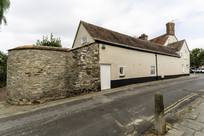
2. C18. Colourwashed brick. Some rubble at south end. Pitched tile roof. Stone slates above eaves. 1 tall red brick stack. 1 storey. 1 modern door, 1 contemporary planked door with air holes.
Nos 1 and 2 Gold Court, Mint House, No 13 and the Horse and Groom Public House form a group.
Listing NGR: SY9242387227
External links are from the relevant listing authority and, where applicable, Wikidata. Wikidata IDs may be related buildings as well as this specific building. If you want to add or update a link, you will need to do so by editing the Wikidata entry.


Other nearby listed buildings