Latitude: 50.6103 / 50°36'37"N
Longitude: -1.9768 / 1°58'36"W
OS Eastings: 401738
OS Northings: 78954
OS Grid: SZ017789
Mapcode National: GBR 33Y.R1G
Mapcode Global: FRA 67RG.7PC
Plus Code: 9C2WJ26F+47
Entry Name: The Methodist Church
Listing Date: 21 March 1983
Grade: II
Source: Historic England
Source ID: 1119916
English Heritage Legacy ID: 108139
Also known as: Ebenezer Methodist Chapel, Herston
ID on this website: 101119916
Location: Herston, Dorset, BH19
County: Dorset
Civil Parish: Swanage
Built-Up Area: Swanage
Traditional County: Dorset
Lieutenancy Area (Ceremonial County): Dorset
Church of England Parish: Swanage St Mary the Virgin
Church of England Diocese: Salisbury
Tagged with: Protestant church building
BELL STREET 1. 5190 (west side) The Methodist Church SZ 0178 3/13 II GV
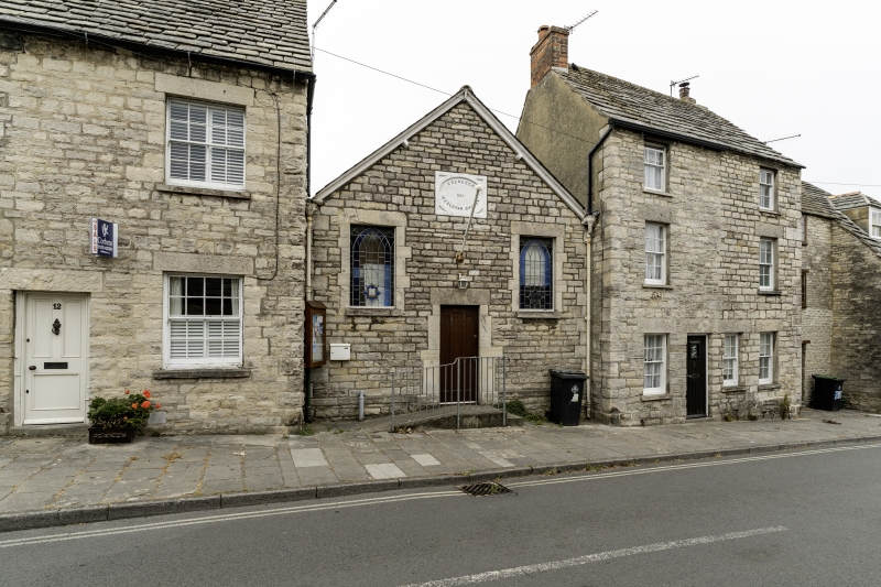
2. Built 1861. Purbeck Stone walls, slate roof. Gable end to street. Facade has modern door and 2 windows with lead lights. Tablet over door inscribed "Ebenezer Wesleyan Chapel 1861". Included for group value.
Listing NGR: SZ0173878954
External links are from the relevant listing authority and, where applicable, Wikidata. Wikidata IDs may be related buildings as well as this specific building. If you want to add or update a link, you will need to do so by editing the Wikidata entry.


Other nearby listed buildings