Latitude: 50.7178 / 50°43'3"N
Longitude: -2.4103 / 2°24'37"W
OS Eastings: 371131
OS Northings: 90984
OS Grid: SY711909
Mapcode National: GBR PZ.B965
Mapcode Global: FRA 57V5.SZ3
Plus Code: 9C2VPH9Q+4V
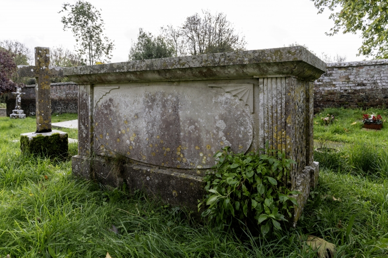
Entry Name: Cull Monument, in the Churchyard 5M South of the South Wall of the Church of Saint Michael
Listing Date: 10 March 1987
Grade: II
Source: Historic England
Source ID: 1119854
English Heritage Legacy ID: 106318
ID on this website: 101119854
Location: St Michael's Church, Stinsford, Dorset, DT2
County: Dorset
Civil Parish: Stinsford
Traditional County: Dorset
Lieutenancy Area (Ceremonial County): Dorset
Church of England Parish: Stinsford St Michael
Church of England Diocese: Salisbury
Tagged with: Building
STINSFORD SY 79 SW
8/130 Cull monument, in the churchyard 5m south of the south wall of the Church of Saint Michael
GV II
Stone table tomb, with moulded top, reeded angle pilasters, and oval panels in sides, with inscription to Francis Cull, 1839.
Listing NGR: SY7113490984
External links are from the relevant listing authority and, where applicable, Wikidata. Wikidata IDs may be related buildings as well as this specific building. If you want to add or update a link, you will need to do so by editing the Wikidata entry.


Other nearby listed buildings