Latitude: 51.8034 / 51°48'12"N
Longitude: -0.8642 / 0°51'51"W
OS Eastings: 478410
OS Northings: 212247
OS Grid: SP784122
Mapcode National: GBR C1J.Y1Y
Mapcode Global: VHDV3.YXZX
Plus Code: 9C3XR43P+98
Entry Name: Church of St John the Baptist
Listing Date: 21 December 1967
Grade: II*
Source: Historic England
Source ID: 1118457
English Heritage Legacy ID: 42735
Also known as: St John the Baptist's Church, Stone, Buckinghamshire
ID on this website: 101118457
Location: St John the Baptist's Church, Upper Hartwell, Buckinghamshire, HP17
County: Buckinghamshire
Civil Parish: Stone with Bishopstone and Hartwell
Built-Up Area: Stone
Traditional County: Buckinghamshire
Lieutenancy Area (Ceremonial County): Buckinghamshire
Church of England Parish: Stone with Dinton and Hartwell
Church of England Diocese: Oxford
Tagged with: Church building
SP 71 SE STONE CHURCH WAY east side
3/165 Church of St. John the Baptist
21.12.67 II*
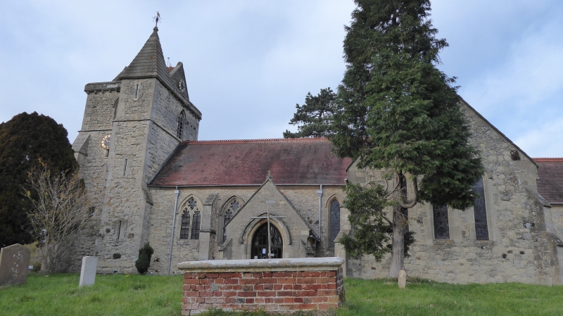
Parish Church. Stone. Tiled roof with ridge chesting. Norman nave and N. doorway. C13 transepts. C14 W. tower with C19 saddleback roof, stair turret to S.E., projecting parapet with carved corbel heads and gargoyles. Restored C19, chancel 1845. Decorated style traceried S.aisle windows, C19 S. porch over Norman door with zig-zag arch, capitals with palmette and leaf motifs, lancet windows to transepts and chancel. Interior: N. arcade is Norman with carved pier capitals, W. bay C13. C14 tower arch. Font Norman, originally at Hampstead Norrey, Berks, brought here in 1845. Cylindrical carved with interlace patterns and scene of man fighting beast. Brasses in nave to William Gurney 1472 and Thomas Gurney 1520. Benches with poppyheads in nave. RCHM I p. 290 MON.2 (part).
Listing NGR: SP7841012247
External links are from the relevant listing authority and, where applicable, Wikidata. Wikidata IDs may be related buildings as well as this specific building. If you want to add or update a link, you will need to do so by editing the Wikidata entry.


Other nearby listed buildings