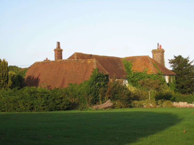
Latitude: 51.4809 / 51°28'51"N
Longitude: -1.3543 / 1°21'15"W
OS Eastings: 444936
OS Northings: 175974
OS Grid: SU449759
Mapcode National: GBR 80Z.0FQ
Mapcode Global: VHCZ4.G1XJ
Plus Code: 9C3WFJJW+97
Entry Name: Chapel Farm House
Listing Date: 6 April 1967
Grade: II
Source: Historic England
Source ID: 1117164
English Heritage Legacy ID: 39947
ID on this website: 101117164
LECKHAMPSTEAD HILLGREEN SU 47 NW 7/45 Chapel Farm House
6.4. 67 II
Farmhouse. Early C16 altered and extended in C17, C18, C19 and C20. Brick with some timberframing exposed on east, tiled roofs. L plan with C19 wing breaking forward to south of east end, formed of C16 wing to north, C17 wing running east/west with early C16 wing partly overbuilt to east, the whole re-fronted C18, some small C20 extensions to north. Two storeys, brick band at first floor, large panelled chimney to east flank, chimney on ridge of north wing. South Elevation:- to right hipped projecting wing with tripartite sash; to left four tripartite sashes except the third from the left which is single above a 6-panelled door with four pane rectangular fanlight under a Doric porch of two columns, two pilasters and entablature. 'Interior:- 3 bays of timber framing to north with chamfered and stopped joists in northern bay, re-modelled main ground floor rooms with plaster cornice to south west room and large moulded beams. in eastern room with cavetto and double ovolo moulding, one of which has mortices for diamond mullioned window.
Listing NGR: SU4493675974
External links are from the relevant listing authority and, where applicable, Wikidata. Wikidata IDs may be related buildings as well as this specific building. If you want to add or update a link, you will need to do so by editing the Wikidata entry.


Other nearby listed buildings