Latitude: 50.8002 / 50°48'0"N
Longitude: -3.1887 / 3°11'19"W
OS Eastings: 316326
OS Northings: 100747
OS Grid: ST163007
Mapcode National: GBR LX.YXN3
Mapcode Global: FRA 466Z.9KJ
Plus Code: 9C2RRR26+3G
Entry Name: Church of St Paul
Listing Date: 1 June 1949
Grade: II
Source: Historic England
Source ID: 1116954
English Heritage Legacy ID: 442573
Also known as: St Paul's Church, Honiton
ID on this website: 101116954
Location: Honiton, East Devon, EX14
County: Devon
District: East Devon
Civil Parish: Honiton
Built-Up Area: Honiton
Traditional County: Devon
Lieutenancy Area (Ceremonial County): Devon
Church of England Parish: Honiton with Monkton
Church of England Diocese: Exeter
Tagged with: Church building
1. HIGH STREET 1228 (North Side) Church of St Paul ST 1600 1/1 1.6.49
II
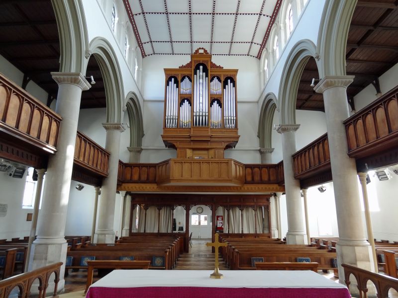
2. Parish Church. Completed 1838, Charles Fowler, Architect. Romanesque style with apse. 7 bays with round-arched aisle and clerestorey windows Galleries. Restored 1849.
Listing NGR: ST1633100731
External links are from the relevant listing authority and, where applicable, Wikidata. Wikidata IDs may be related buildings as well as this specific building. If you want to add or update a link, you will need to do so by editing the Wikidata entry.


Other nearby listed buildings