Latitude: 51.4833 / 51°28'59"N
Longitude: -2.4844 / 2°29'3"W
OS Eastings: 366456
OS Northings: 176153
OS Grid: ST664761
Mapcode National: GBR JW.KV1B
Mapcode Global: VH88H.WZF8
Plus Code: 9C3VFGM8+86
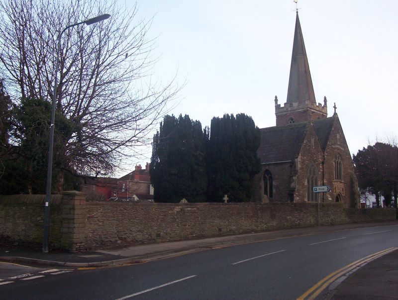
Entry Name: Churchyard Wall to Church of St James
Listing Date: 15 July 1981
Grade: II
Source: Historic England
Source ID: 1116193
English Heritage Legacy ID: 28811
ID on this website: 101116193
Location: St James's Church, Blackhorse, South Gloucestershire, BS16
County: South Gloucestershire
Parish: Non Civil Parish
Built-Up Area: Bristol
Traditional County: Gloucestershire
Lieutenancy Area (Ceremonial County): Gloucestershire
Church of England Parish: Mangotsfield
Church of England Diocese: Bristol
Tagged with: Churchyard wall
1. 5118 EX-MANGOTSFIELD UD ST JAMES'S STREET Churchyard wall to Church of St James (approx 40 yds to St James's Street and approx 50 yds to Cossham Street) ST 67 NE 2/199A II GV 2. Extends to south about 40 yds and to west about 50 yds. Circa 1843, pennant stone rubble about 3-4 ft high. Dressed coping. Railing removed. Arched overthrow.
Listing NGR: ST6645676153
External links are from the relevant listing authority and, where applicable, Wikidata. Wikidata IDs may be related buildings as well as this specific building. If you want to add or update a link, you will need to do so by editing the Wikidata entry.


Other nearby listed buildings