Latitude: 51.2462 / 51°14'46"N
Longitude: 0.3217 / 0°19'18"E
OS Eastings: 562138
OS Northings: 152229
OS Grid: TQ621522
Mapcode National: GBR NPT.XTZ
Mapcode Global: VHHPV.JYF1
Plus Code: 9F3268WC+FM
Entry Name: Hamptons
Listing Date: 1 August 1952
Grade: II
Source: Historic England
Source ID: 1115659
English Heritage Legacy ID: 178964
ID on this website: 101115659
Location: Roughway, Tonbridge and Malling, Kent, TN11
County: Kent
District: Tonbridge and Malling
Civil Parish: West Peckham
Traditional County: Kent
Lieutenancy Area (Ceremonial County): Kent
Church of England Parish: West Peckham St Dunstan
Church of England Diocese: Rochester
Tagged with: Building
TQ 65 SW WEST PECKHAM PARK ROAD (north side)
1/1 Eamptons
1.8.52
- II
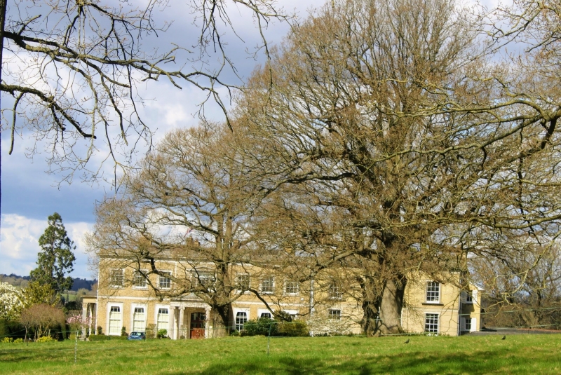
In the process of building 1813, an early work by R W Jearrad, of Cheltenham fame. Yellow brick with stone plinth, band and parapet and coping. Low pitched slate roof. 2 storeys, rectangular in plan, including later Victorian kitchen wing, 7 bay south front, with 3 bay kitchen wing to east. Sash windows with moulded surrounds and flat hoods on ground-floor. Central 1-bay projection with pedimented tripartite window on 1st floor. Projecting ponte cochere with two pairs of Greek Ionic columns. Veranda on west return front with panelled Corinthian supports. According to Pevsner the house was gabled in 1883.
Listing NGR: TQ6213852229
External links are from the relevant listing authority and, where applicable, Wikidata. Wikidata IDs may be related buildings as well as this specific building. If you want to add or update a link, you will need to do so by editing the Wikidata entry.


Other nearby listed buildings