Latitude: 54.8213 / 54°49'16"N
Longitude: -1.741 / 1°44'27"W
OS Eastings: 416742
OS Northings: 547417
OS Grid: NZ167474
Mapcode National: GBR JD8P.WG
Mapcode Global: WHC4G.727Q
Plus Code: 9C6WR7C5+GJ
Entry Name: The Deanery
Listing Date: 24 June 1987
Grade: II
Source: Historic England
Source ID: 1115559
English Heritage Legacy ID: 350583
ID on this website: 101115559
Location: Lanchester, County Durham, DH7
County: County Durham
Civil Parish: Lanchester
Built-Up Area: Lanchester
Traditional County: Durham
Lieutenancy Area (Ceremonial County): County Durham
Church of England Parish: Lanchester and Burnhope
Church of England Diocese: Durham
Tagged with: Building
LANCHESTER DURHAM ROAD NZ 1647 (North side) Lanchester
13/76 The Deanery (shown as The Old Parsonage on O.S. map)
GV II
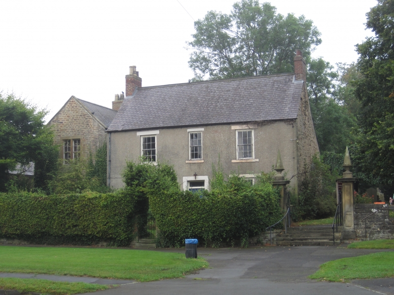
House. Probably mid C18 with C19 left addition and alterations. Left part coursed squared sandstone with ashlar dressings; right part pebble-dashed render with painted ashlar dressings; roofs of Welsh slate, with stone gable copings on left part; brick chimneys. L-plan. Main building at right 2 storeys, 3 bays. Central panelled door and overlight in slightly-chamfered plain stone surround; flat stone lintels and slightly-projecting stone sills to 12-pane sashes in shallow reveals; window over door narrower. End chimneys.
Left part, under gable to street, 2 storeys, one bay, set back slightly: paired 8-pane sashes in chamfered surrounds; gable coping on moulded kneelers.
Interior not inspected.
Listing NGR: NZ1674247417
External links are from the relevant listing authority and, where applicable, Wikidata. Wikidata IDs may be related buildings as well as this specific building. If you want to add or update a link, you will need to do so by editing the Wikidata entry.


Other nearby listed buildings