Latitude: 51.1104 / 51°6'37"N
Longitude: 0.8782 / 0°52'41"E
OS Eastings: 601564
OS Northings: 138507
OS Grid: TR015385
Mapcode National: GBR SYM.6W0
Mapcode Global: VHKKV.5CM3
Plus Code: 9F324V6H+57
Entry Name: Finn Farm Oast
Listing Date: 10 October 1980
Grade: II
Source: Historic England
Source ID: 1115435
English Heritage Legacy ID: 181018
ID on this website: 101115435
Location: Ashford, Kent, TN23
County: Kent
District: Ashford
Civil Parish: Kingsnorth
Built-Up Area: Kingsnorth (Ashford)
Traditional County: Kent
Lieutenancy Area (Ceremonial County): Kent
Tagged with: Drying house
This list entry was subject to a Minor Amendment on 12 November 2025 to amend the name and address and reformat the text to current standards
TR O3 NW
20/12B
KINGSNORTH
FINN FARM ROAD
Finn Farm Oast
(Formerly listed as Oasthouse to north-west of Finn Farmhouse)
II
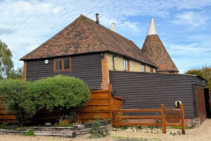
C19. Two storeys ragstone with red brick dressings. Hipped tiled roof. Casement windows. Three brick roundels with conical tiled roofs. No cowls or fantails.
Listing NGR: TR0153038489
External links are from the relevant listing authority and, where applicable, Wikidata. Wikidata IDs may be related buildings as well as this specific building. If you want to add or update a link, you will need to do so by editing the Wikidata entry.


Other nearby listed buildings