Latitude: 51.4047 / 51°24'16"N
Longitude: -2.3151 / 2°18'54"W
OS Eastings: 378177
OS Northings: 167340
OS Grid: ST781673
Mapcode National: GBR 0Q5.X34
Mapcode Global: VH96F.TYGK
Plus Code: 9C3VCM3M+VX
Entry Name: Portals (Bathford) Limited
Listing Date: 19 October 1983
Grade: II
Source: Historic England
Source ID: 1115237
English Heritage Legacy ID: 32116
ID on this website: 101115237
Location: Batheaston, Bath and North East Somerset, Somerset, BA1
County: Bath and North East Somerset
Civil Parish: Batheaston
Built-Up Area: Bath
Traditional County: Somerset
Lieutenancy Area (Ceremonial County): Somerset
Tagged with: Building
ST 76 NE BATHEASTON C.P. LONDON ROAD EAST (North-east side) 1/73 No. 251 [Portals (Bathford) G.V. Ltd]
II
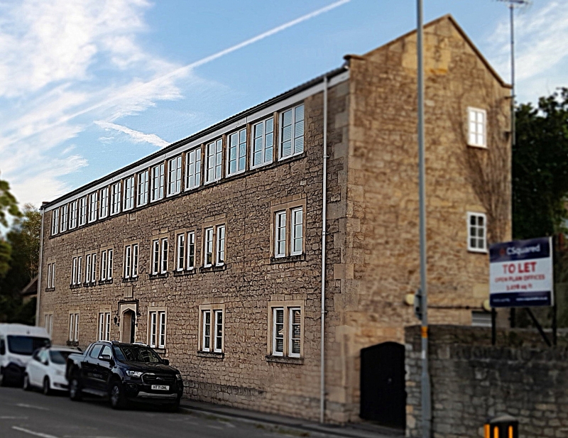
Poor House now offices. Dated 1821 in centre. Coursed rubble with freestone dressings, quoins; modern tiled roof. 3 storeys. 9 2-light casements with plain stone mullions and surrounds; continuous row of 16 2-light casements on 2nd floor (originally alternate windows were blocked). Modern door to left. Blocked central doorway with semi-circular head. Dobbie B.M.W., An English Rural Community, 1969.
Listing NGR: ST7817767340
External links are from the relevant listing authority and, where applicable, Wikidata. Wikidata IDs may be related buildings as well as this specific building. If you want to add or update a link, you will need to do so by editing the Wikidata entry.


Other nearby listed buildings