Latitude: 51.3932 / 51°23'35"N
Longitude: -2.3306 / 2°19'50"W
OS Eastings: 377096
OS Northings: 166070
OS Grid: ST770660
Mapcode National: GBR 0QB.RKM
Mapcode Global: VH96M.K78T
Plus Code: 9C3V9MV9+7Q
Entry Name: Dinas
Listing Date: 19 October 1983
Grade: II
Source: Historic England
Source ID: 1115188
English Heritage Legacy ID: 32004
ID on this website: 101115188
Location: Bathampton, Bath and North East Somerset, Somerset, BA2
County: Bath and North East Somerset
Civil Parish: Bathampton
Built-Up Area: Bath
Traditional County: Somerset
Lieutenancy Area (Ceremonial County): Somerset
Tagged with: Building
ST 7766 BATHAMPTON C.P. BATHAMPTON LANE (North-west side) 8/6 Dinas G.V. II
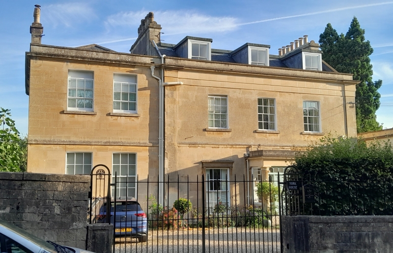
House. Early Cl9th. Ashlar; slate roof behind parapet, projecting cornice. 2 storeys and attics in dormers, and basement. 3 bays. Glazing bar sash windows in architraves on ground floor. String course. Central projecting porch with Doric columns, panelled door under overlight. Later Cl9th, 2 window wing to left.
Listing NGR: ST7709666070
External links are from the relevant listing authority and, where applicable, Wikidata. Wikidata IDs may be related buildings as well as this specific building. If you want to add or update a link, you will need to do so by editing the Wikidata entry.


Other nearby listed buildings