Latitude: 51.5639 / 51°33'49"N
Longitude: -2.339 / 2°20'20"W
OS Eastings: 376594
OS Northings: 185055
OS Grid: ST765850
Mapcode National: GBR 0N6.X0P
Mapcode Global: VH95N.DYSH
Plus Code: 9C3VHM76+H9
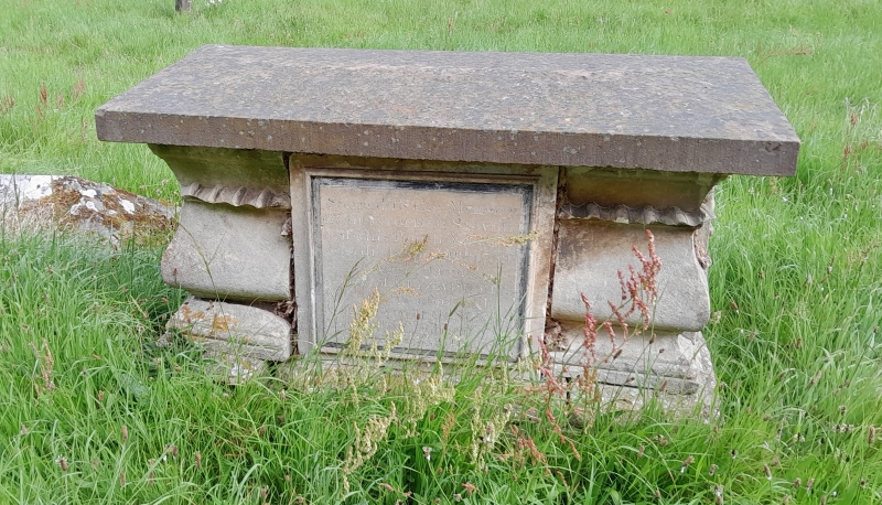
Entry Name: Slade Chest Tomb, 6 Yards North of North Door of St James' Church
Listing Date: 5 June 1984
Grade: II
Source: Historic England
Source ID: 1114994
English Heritage Legacy ID: 34696
ID on this website: 101114994
Location: St James's Church, South Gloucestershire, BS37
County: South Gloucestershire
Civil Parish: Horton
Traditional County: Gloucestershire
Lieutenancy Area (Ceremonial County): Gloucestershire
Church of England Parish: Horton St James the Elder
Church of England Diocese: Gloucester
Tagged with: Chest tomb
ST 78 NE
5/72
HORTON
Slade Chest Tomb, 6 yards north of north door of St. James' Church
G.V.
II
Chest tomb. Christopher Slade, died 1759. Limestone ashlar. Central square
inscribed panel; wide enriched corner balusters; moulded plinth and cornice.
The chest tombs represent a good collection of local and classical tomb forms and
contribute greatly to the setting of the church.
Listing NGR: ST7659485055
External links are from the relevant listing authority and, where applicable, Wikidata. Wikidata IDs may be related buildings as well as this specific building. If you want to add or update a link, you will need to do so by editing the Wikidata entry.


Other nearby listed buildings