Latitude: 51.4615 / 51°27'41"N
Longitude: -2.3204 / 2°19'13"W
OS Eastings: 377837
OS Northings: 173658
OS Grid: ST778736
Mapcode National: GBR 0PL.865
Mapcode Global: VH967.QJNH
Plus Code: 9C3VFM6H+HR
Entry Name: 5, Sheep Fair Lane
Listing Date: 10 November 1983
Grade: II
Source: Historic England
Source ID: 1114951
English Heritage Legacy ID: 34582
ID on this website: 101114951
Location: Marshfield, South Gloucestershire, SN14
County: South Gloucestershire
Civil Parish: Marshfield
Built-Up Area: Marshfield
Traditional County: Gloucestershire
Lieutenancy Area (Ceremonial County): Gloucestershire
Church of England Parish: Marshfield
Church of England Diocese: Bristol
Tagged with: Building
MARSHFIELD C.P. SHEEP FAIR LANE (west side) ST 7773 13/169 No. 5
G.V. II
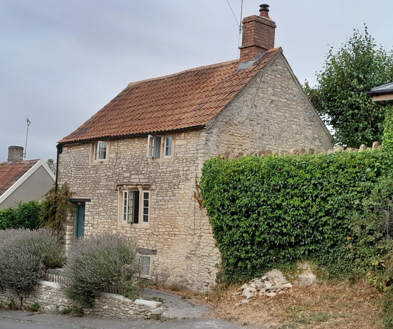
House. Late C17. Rubble; double Roman tiled roof. 2 storeys. Single bay and C20 door, 2- and 3-light casement window in moulded mullions and surrounds.
Listing NGR: ST7783773658
External links are from the relevant listing authority and, where applicable, Wikidata. Wikidata IDs may be related buildings as well as this specific building. If you want to add or update a link, you will need to do so by editing the Wikidata entry.


Other nearby listed buildings