Latitude: 52.0547 / 52°3'16"N
Longitude: -0.272 / 0°16'19"W
OS Eastings: 518577
OS Northings: 240997
OS Grid: TL185409
Mapcode National: GBR H4Q.41Y
Mapcode Global: VHGN6.7MK7
Plus Code: 9C4X3P3H+V5
Entry Name: 2, High Street
Listing Date: 2 January 1985
Grade: II
Source: Historic England
Source ID: 1113842
English Heritage Legacy ID: 37841
ID on this website: 101113842
Location: Langford, Central Bedfordshire, SG18
County: Central Bedfordshire
Civil Parish: Langford
Built-Up Area: Langford
Traditional County: Bedfordshire
Lieutenancy Area (Ceremonial County): Bedfordshire
Church of England Parish: Langford
Church of England Diocese: St.Albans
Tagged with: Building
TL 14 SE LANGFORD HIGH STREET 1/52 (West side)
No.2
II
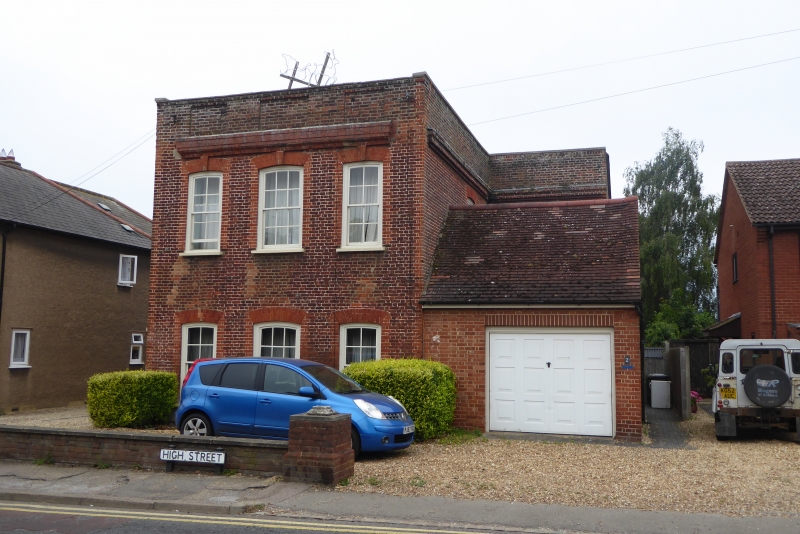
House, Mid C18, with C19 additions and alterations. Red brick. Original block has hipped tiled-roof, rear block has slate roof. Truncated remains of larger 2 storeyed building. Now consists of 2-storeyed L-plan, the projecting LH block and the front wall of the rear block being C18, the rest of the rear block C19. Later single-storeyed block, now a garage, within angle. Front elevation, original block: 3-window range of flush sashes with glazing bars. All have segmental heads, first floor ones have moulded brick keystones. Moulded brick cornice surmounted by brick parapet with recessed panels.
Listing NGR: TL1857740997
External links are from the relevant listing authority and, where applicable, Wikidata. Wikidata IDs may be related buildings as well as this specific building. If you want to add or update a link, you will need to do so by editing the Wikidata entry.


Other nearby listed buildings