Latitude: 52.0306 / 52°1'50"N
Longitude: -0.2857 / 0°17'8"W
OS Eastings: 517704
OS Northings: 238296
OS Grid: TL177382
Mapcode National: GBR H4X.LM2
Mapcode Global: VHGND.07B5
Plus Code: 9C4X2PJ7+6P
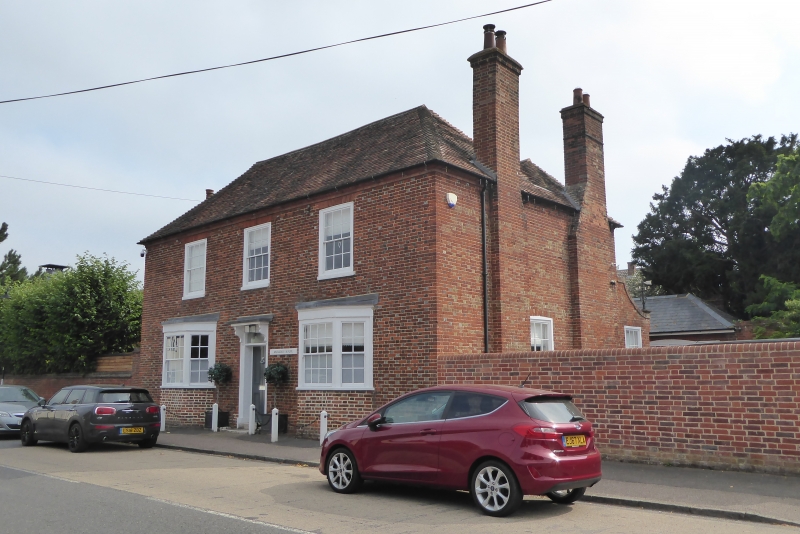
Entry Name: Mulberry House
Listing Date: 2 January 1985
Grade: II
Source: Historic England
Source ID: 1113838
English Heritage Legacy ID: 37835
ID on this website: 101113838
Location: Henlow, Central Bedfordshire, SG16
County: Central Bedfordshire
Civil Parish: Henlow
Built-Up Area: Henlow
Traditional County: Bedfordshire
Lieutenancy Area (Ceremonial County): Bedfordshire
Church of England Parish: Henlow
Church of England Diocese: St.Albans
Tagged with: House
TL 1738
12/46
HENLOW
HIGH STREET
(East side)
No.44 (Mulberry House)
II
House. Later C18. Red brick with vitrified headers. Hipped 2-span clay
tile roof. Double-pile plan, 2 storeys. Ground floor has 2 canted bays,
first floor has 3 sashes, all with glazing bars. Flat gauged brick heads to
first floor windows. Central 4 panel door with rectangular fanlight and
flat hood on cut brackets. Moulded brick cornice to eaves. Slightly
projecting red brick chimney stacks to side elevations.
Listing NGR: TL1770438296
External links are from the relevant listing authority and, where applicable, Wikidata. Wikidata IDs may be related buildings as well as this specific building. If you want to add or update a link, you will need to do so by editing the Wikidata entry.


Other nearby listed buildings