Latitude: 51.4574 / 51°27'26"N
Longitude: -0.966 / 0°57'57"W
OS Eastings: 471939
OS Northings: 173669
OS Grid: SU719736
Mapcode National: GBR QND.3Z
Mapcode Global: VHDWT.6MPL
Plus Code: 9C3XF24M+XJ
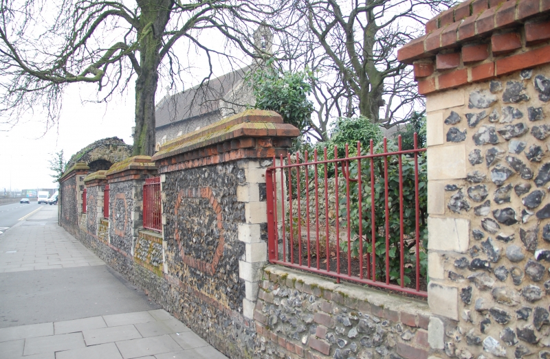
Entry Name: The Plummery Wall
Listing Date: 14 December 1978
Grade: II
Source: Historic England
Source ID: 1113482
English Heritage Legacy ID: 38946
ID on this website: 101113482
Location: Reading, Berkshire, RG1
County: Reading
Electoral Ward/Division: Abbey
Parish: Non Civil Parish
Built-Up Area: Reading
Traditional County: Berkshire
Lieutenancy Area (Ceremonial County): Berkshire
Church of England Parish: Reading St Mary the Virgin
Church of England Diocese: Oxford
FORBURY ROAD 1. 5128 (North Side) The Plummery Wall SU 7173 NE 1/488 SU 7273 7/488 II 2. Mid C19 wall on site of and probably incorporating the mediaeval Plummery wall Dwarf wall of mixed flint and random rubble and brick with low mid-C19 railings. North side about 8 feet high.
Listing NGR: SU7200573664
External links are from the relevant listing authority and, where applicable, Wikidata. Wikidata IDs may be related buildings as well as this specific building. If you want to add or update a link, you will need to do so by editing the Wikidata entry.


Other nearby listed buildings