Latitude: 50.9459 / 50°56'45"N
Longitude: -2.5171 / 2°31'1"W
OS Eastings: 363769
OS Northings: 116405
OS Grid: ST637164
Mapcode National: GBR MV.NL40
Mapcode Global: FRA 56ML.TFW
Plus Code: 9C2VWFWM+95
Entry Name: Former Hospital of Saints John the Baptist and John the Evangelist
Listing Date: 28 November 1950
Grade: I
Source: Historic England
Source ID: 1110827
English Heritage Legacy ID: 103816
Also known as: Almshouse of St John the Baptist and St John the Evangelist
ID on this website: 101110827
Location: Sherborne, Dorset, DT9
County: Dorset
Civil Parish: Sherborne
Built-Up Area: Sherborne
Traditional County: Dorset
Lieutenancy Area (Ceremonial County): Dorset
Church of England Parish: Sherborne with Castleton Abbey Church of St Mary
Church of England Diocese: Salisbury
Tagged with: Architectural structure
This list entry was subject to a Minor Amendment on 28 January 2026 to update the Name and Address and reformat the text to current standards
ST 6316
1/2
ABBEY CLOSE
Former Hospital of Saints John the Baptist and John the Evangelist
(Formerly listed as Hospital of Saints John the Baptist and John the Evangelist)
28.11.50.
GV
I
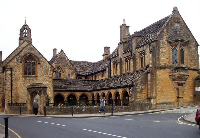
Founded 1437 for 12 poor men and four poor women. Building completed 1448. This appears to have been L-shaped, the main range having a frontage to Trendle Street. The East wing, providing additional accommodation, new Board Room with oriel window, and Cloister was built in 1866 according to a design by William Slater on ground presented the previous year.
The East end of the Trendle Street range contains the Chapel with Perpendicular windows to South and East the former containing C15 glass. A stone arch and carved oak screen separate the chapel from the ante-chapel. The alter-piece is a triptych in oils on oak panel and is of very great interest, being C15 and probably Flemish.
The western part of the range is two-storey, containing Ante-chapel and Dining Hall below and Dormitories and the old Board-Room above. The open timber roof is visible in the upper rooms. Trendle Street front has entrance to Ante-Chapel (original main entrance) with pointed arch and carved spandrels. This is flanked by niches with ogee heads and crockets.
All the listed buildings in Abbey Close form a group with the east end of No 1 Finger Lane.
Also forms a group with Premises occupied by Mr Hunt, Digby Estate Nos 170 and 171 and Cottages known as Nos 4 and 2 Trendle Street and with the former Church House and Public Weighbridge House, Half Moon Street.
Listing NGR: ST6377316420
External links are from the relevant listing authority and, where applicable, Wikidata. Wikidata IDs may be related buildings as well as this specific building. If you want to add or update a link, you will need to do so by editing the Wikidata entry.


Other nearby listed buildings