Latitude: 53.0821 / 53°4'55"N
Longitude: -1.5727 / 1°34'21"W
OS Eastings: 428722
OS Northings: 353965
OS Grid: SK287539
Mapcode National: GBR 59G.R6K
Mapcode Global: WHCDV.TS9J
Plus Code: 9C5W3CJG+VW
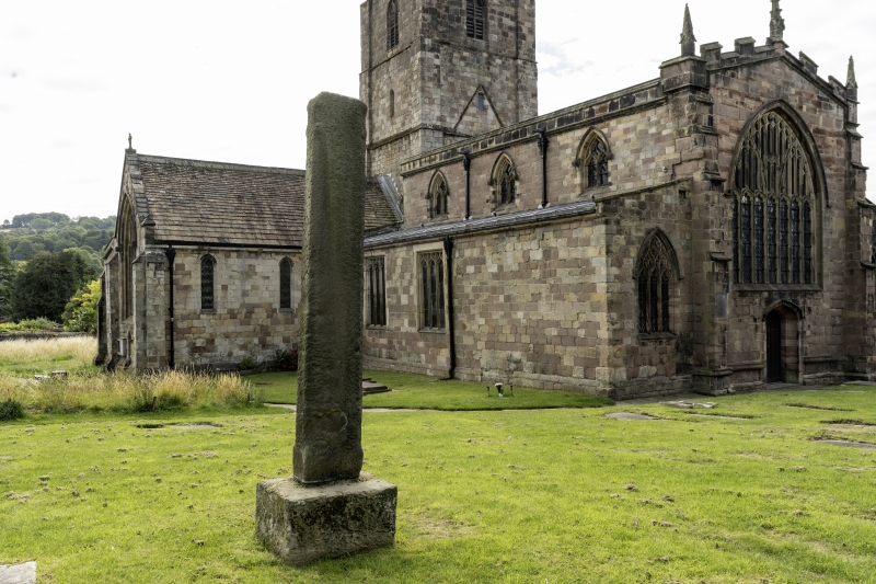
Entry Name: Churchyard Cross
Listing Date: 24 October 1950
Grade: II
Source: Historic England
Source ID: 1109612
English Heritage Legacy ID: 79689
ID on this website: 101109612
Location: St Mary's Church, Wirksworth, Derbyshire Dales, Derbyshire, DE4
County: Derbyshire
District: Derbyshire Dales
Civil Parish: Wirksworth
Built-Up Area: Wirksworth
Traditional County: Derbyshire
Lieutenancy Area (Ceremonial County): Derbyshire
Church of England Parish: Wirksworth St Mary
Church of England Diocese: Derby
1.
1839
SK 2853
2/5
24.10.50
CHURCH YARD
Churchyard Cross
II
2.
A C13 headless stone shaft on earlier small plain base.
Listing NGR: SK2872253965


Other nearby listed buildings