Latitude: 53.1973 / 53°11'50"N
Longitude: -1.2829 / 1°16'58"W
OS Eastings: 448005
OS Northings: 366934
OS Grid: SK480669
Mapcode National: GBR 7C5.DJ9
Mapcode Global: WHDFK.8WCQ
Plus Code: 9C5W5PW8+WV
Entry Name: Glapwell Lane House
Listing Date: 8 July 1966
Grade: II
Source: Historic England
Source ID: 1108922
English Heritage Legacy ID: 79299
ID on this website: 101108922
Location: Glapwell, Bolsover, Derbyshire, S44
County: Derbyshire
District: Bolsover
Civil Parish: Glapwell
Built-Up Area: Glapwell
Traditional County: Derbyshire
Lieutenancy Area (Ceremonial County): Derbyshire
Church of England Parish: Ault Hucknall St John the Baptist
Church of England Diocese: Derby
Tagged with: House
SK 46 NE PARISH OF GLAPWELL GLAPWELL LANE 7/129 (East Side) 8.7.66 Glapwell Lane House II
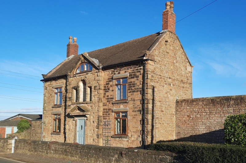
Farmhouse. Mid C18, altered in C20. Coursed squared sandstone with sandstone dressings and chamfered quoins. Machine tile roof with brick gable stack and stone coped gables with moulded kneelers. Two storeys. West elevation of three symmetrical bays. The centre bay advanced and with a pedimented gable. Central doorway with bracketted pediment. C20 panelled door. Flanked by C20 cross windows under plain lintels. The first floor has a blind Venetian window in the centre, with keyed rusticated surround and curved niche to the centre. Flanked by C20 cross windows under plain lintels. In the pediment is a shallow lunette window.
Listing NGR: SK4800566934
External links are from the relevant listing authority and, where applicable, Wikidata. Wikidata IDs may be related buildings as well as this specific building. If you want to add or update a link, you will need to do so by editing the Wikidata entry.


Other nearby listed buildings