Latitude: 50.2257 / 50°13'32"N
Longitude: -3.8131 / 3°48'47"W
OS Eastings: 270765
OS Northings: 37764
OS Grid: SX707377
Mapcode National: GBR QF.2B64
Mapcode Global: FRA 28XF.D95
Plus Code: 9C2R65GP+7Q
Entry Name: Lower Soar
Listing Date: 19 February 1990
Grade: II
Source: Historic England
Source ID: 1108478
English Heritage Legacy ID: 100729
ID on this website: 101108478
Location: South Hams, Devon, TQ7
County: Devon
District: South Hams
Civil Parish: Malborough
Traditional County: Devon
Lieutenancy Area (Ceremonial County): Devon
Church of England Parish: Malborough All Saints
Church of England Diocese: Exeter
Tagged with: Building Thatched farmhouse
MALBOROUGH SX 73 NW 8/33 Lower Soar
II
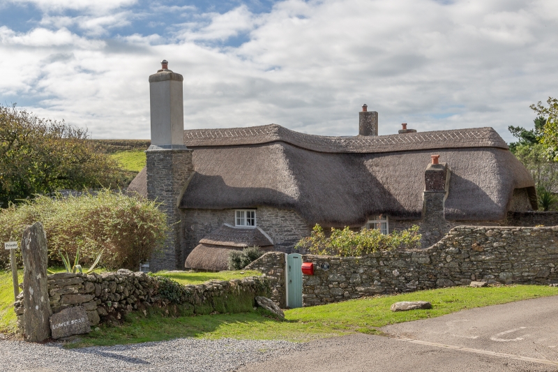
Farmhouse. C17 possibly incorporating some earlier fabric, much remodelled in C18 and C19 with C20 alterations. Slatestone rubble walls. Thatch roof gabled to left end, half hipped to front and rear wings. 2 rendered rubble stacks with brick shafts and 2 rubble stacks with brick shafts. Plan: originally either 2 or 3-room-and-through-passage plan, lower end to the left. Hall stack backs onto the passage. At its higher end is a cross wing of uncertain date since it has no dateable features but probably later C17 or C18, and behind it is a smaller rear wing, probably C18 or early C19. In the C20 the internal room arrangement was altered and the passage changed. Exterior: 2 storeys. Asymmetrical 4 window front with wing projecting from right-hand end. Later C20 small-paned 2 and 3-light casements. C20 glazed door to left of centre. The wing has windows on its inner face and a row of pigeon holes on its end wall. A C19 outbuilding projects from the left-hand end of the house in an L-shaped range forming a courtyard. The rear elevation of the house has a wing projecting at the centre and extending from it is an L-shaped section of wall with a row of 8 bee-boles in it. Interior: considerably altered but hall retains its large Cl7 open fireplace with slate lintel and chamfered and stopped ceiling beams. According to N. Alcock's cruck catalogue there is a cruck roof timber, but this was not seen during the inspection.
Listing NGR: SX7076537764
External links are from the relevant listing authority and, where applicable, Wikidata. Wikidata IDs may be related buildings as well as this specific building. If you want to add or update a link, you will need to do so by editing the Wikidata entry.


Other nearby listed buildings