Latitude: 51.3586 / 51°21'30"N
Longitude: 1.0243 / 1°1'27"E
OS Eastings: 610651
OS Northings: 166508
OS Grid: TR106665
Mapcode National: GBR TX1.MT5
Mapcode Global: VHKJR.P3VV
Plus Code: 9F33925F+CP
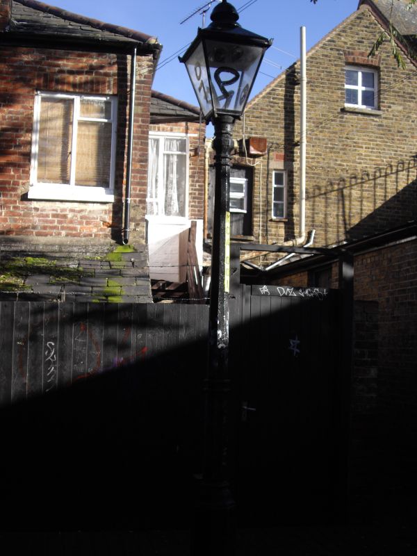
Entry Name: Gas Lantern and Column to Rear of No 68 High Street
Listing Date: 20 May 1977
Grade: II
Source: Historic England
Source ID: 1106358
English Heritage Legacy ID: 170840
ID on this website: 101106358
Location: Whitstable, Canterbury, Kent, CT5
County: Kent
District: Canterbury
Electoral Ward/Division: Gorrell
Parish: Non Civil Parish
Built-Up Area: Whitstable
Traditional County: Kent
Lieutenancy Area (Ceremonial County): Kent
Tagged with: Gas streetlight
KNIGHTS ALLEY 1. 5273 Gas Lantern and Column to rear or No 68 High Street TR 16 SW 1/203 II Mid C19 lantern end column. Cast iron octagonal column with 4 ogee curved braces supporting square type lantern having a smaller base than top. Sloping roof with 2 bell vents. Gas lit.
Listing NGR: TR1065166508
External links are from the relevant listing authority and, where applicable, Wikidata. Wikidata IDs may be related buildings as well as this specific building. If you want to add or update a link, you will need to do so by editing the Wikidata entry.


Other nearby listed buildings