Latitude: 54.5672 / 54°34'1"N
Longitude: -3.1301 / 3°7'48"W
OS Eastings: 327032
OS Northings: 519695
OS Grid: NY270196
Mapcode National: GBR 6HLM.4K
Mapcode Global: WH70D.WGNK
Plus Code: 9C6RHV89+VX
Entry Name: Ashness Bridge
Listing Date: 3 March 1967
Grade: II
Source: Historic England
Source ID: 1106307
English Heritage Legacy ID: 72124
ID on this website: 101106307
Location: Cumberland, Cumbria, CA12
County: Cumberland
District: Allerdale
Civil Parish: Borrowdale
Traditional County: Cumberland
Lieutenancy Area (Ceremonial County): Cumbria
Church of England Parish: Keswick St John
Church of England Diocese: Carlisle
Tagged with: Road bridge
NY 21 NE ST JOHNS CASTLERIGG & WYTHBURN
16/40 Ashness Bridge
II
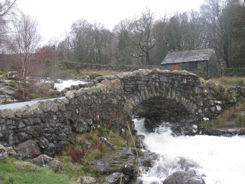
Packhorse bridge. C18 with C19 parapet and C20 widening. Slate rubble. Narrow single-span segmental hump-back bridge, with split-slate voussoirs, under solid parapets and rubble coping. This bridge lies partly in Borrowdale C.P.
Listing NGR: NY2703219695
External links are from the relevant listing authority and, where applicable, Wikidata. Wikidata IDs may be related buildings as well as this specific building. If you want to add or update a link, you will need to do so by editing the Wikidata entry.


Other nearby listed buildings