Latitude: 51.8855 / 51°53'7"N
Longitude: -2.0802 / 2°4'48"W
OS Eastings: 394575
OS Northings: 220770
OS Grid: SO945207
Mapcode National: GBR 2MB.NXC
Mapcode Global: VH947.WVMZ
Plus Code: 9C3VVWP9+5W
Entry Name: 29, Leckhampton Road
Listing Date: 26 November 1998
Grade: II
Source: Historic England
Source ID: 1104389
English Heritage Legacy ID: 474877
ID on this website: 101104389
Location: The Park, Cheltenham, Gloucestershire, GL53
County: Gloucestershire
District: Cheltenham
Electoral Ward/Division: Leckhampton
Parish: Leckhampton with Warden Hill
Built-Up Area: Cheltenham
Traditional County: Gloucestershire
Lieutenancy Area (Ceremonial County): Gloucestershire
Church of England Parish: Leckhampton St Philip and St James
Church of England Diocese: Gloucester
Tagged with: Building
CHELTENHAM
SO9420NE LECKHAMPTON ROAD 630-1/27/459 (West side) No.29
II
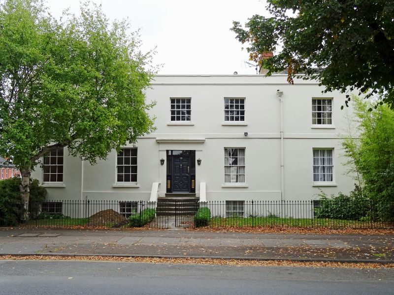
House. c1820-50 in 2 stages of build. Stucco over brick with gabled slate roof to right part, otherwise concealed; brick end and ridge stacks. EXTERIOR: 2 storeys on basement, 5 first-floor windows with service range to rear. 1-window bay at left breaks forwards. First-floor band. First floor has four 8/8 sashes and 6/6 sash at right. Ground floor and basement have 6/6 sashes. Central entrance, flight of steps to panelled door with sidelights and overlight in raised surround with frieze and cornice. Left return is canted and has 8/8 sashes to first floor and 6/6 sashes to ground floor. Rear retains 8/8 sashes. INTERIOR: not inspected.
Listing NGR: SO9457420771
External links are from the relevant listing authority and, where applicable, Wikidata. Wikidata IDs may be related buildings as well as this specific building. If you want to add or update a link, you will need to do so by editing the Wikidata entry.


Other nearby listed buildings