Latitude: 51.8985 / 51°53'54"N
Longitude: -2.0704 / 2°4'13"W
OS Eastings: 395249
OS Northings: 222214
OS Grid: SO952222
Mapcode National: GBR 2M4.Z8N
Mapcode Global: VHB1Q.2K90
Plus Code: 9C3VVWXH+9R
Entry Name: Numbers 21 23 and 25 and Attached Wall Between Numbers 23 and 25 and Railings to Number 25
Listing Date: 5 May 1972
Grade: II
Source: Historic England
Source ID: 1104300
English Heritage Legacy ID: 474667
ID on this website: 101104300
Location: Cheltenham, Gloucestershire, GL52
County: Gloucestershire
District: Cheltenham
Electoral Ward/Division: All Saints
Parish: Non Civil Parish
Built-Up Area: Cheltenham
Traditional County: Gloucestershire
Lieutenancy Area (Ceremonial County): Gloucestershire
Church of England Parish: Cheltenham St Luke and St John
Church of England Diocese: Gloucester
Tagged with: Building
CHELTENHAM
SO9522SW GROSVENOR STREET 630-1/14/358 (East side) 05/05/72 Nos.21, 23 AND 25 and attached wall between Nos 23 and 25 and railings to No.25
GV II
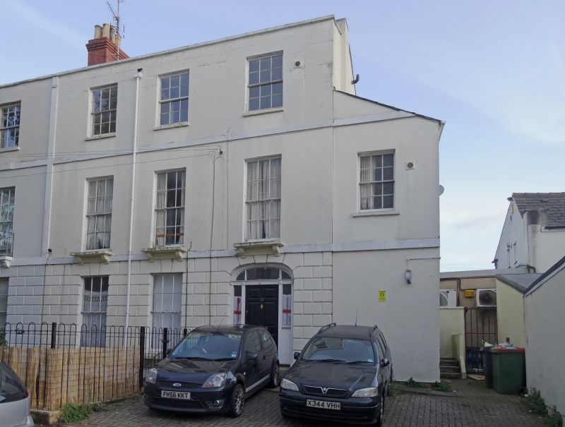
3 houses, now flats, with low wall joining Nos 23 and 25, and attached railings to No.25. c1820-34. Brick over stucco with slate roofs and brick and stucco end stacks, with wrought- and iron railings. EXTERIOR: 3 storeys on basements, 3 first-floor windows each, with 2-storey, single-window range to left. Rustication to ground floor, drawn into voussoirs aver doors. First-floor band. Houses to left have first-floor sills on corbels. Second-floor band. 6/6 sashes where original, taller to ground and first floors, otherwise 2/2 horizontal-pane sashes. Basement has 6/6 sashes. Entrances to right, left and right: 5- and 6-fielded-panel doors with sidelights and basket arched overlights with glazing bars. INTERIOR: retain original joinery including panelled shutters, otherwise not inspected. SUBSIDIARY FEATURES: stick area railings to left. No.23 has first-floor balusters with embellished rods and lattice frieze with central scrolled panels. HISTORICAL NOTE: Grosvenor Street apparently shown as Gyde's Terrace on Merrett's Map of 1834. (Merrett HS: Plan of the Town of Cheltenham: 1834-).
Listing NGR: SO9525622225
External links are from the relevant listing authority and, where applicable, Wikidata. Wikidata IDs may be related buildings as well as this specific building. If you want to add or update a link, you will need to do so by editing the Wikidata entry.


Other nearby listed buildings