Latitude: 50.705 / 50°42'18"N
Longitude: -3.5402 / 3°32'24"W
OS Eastings: 291339
OS Northings: 90616
OS Grid: SX913906
Mapcode National: GBR P0.R3G1
Mapcode Global: FRA 37G6.YD1
Plus Code: 9C2RPF45+2W
Entry Name: The Villa
Listing Date: 18 June 1974
Grade: II
Source: Historic England
Source ID: 1104014
English Heritage Legacy ID: 89003
ID on this website: 101104014
Location: Alphington, Exeter, Devon, EX2
County: Devon
District: Exeter
Electoral Ward/Division: Alphington
Parish: Non Civil Parish
Built-Up Area: Exeter
Traditional County: Devon
Lieutenancy Area (Ceremonial County): Devon
Church of England Parish: Exeter St Thomas the Apostle
Church of England Diocese: Exeter
Tagged with: House
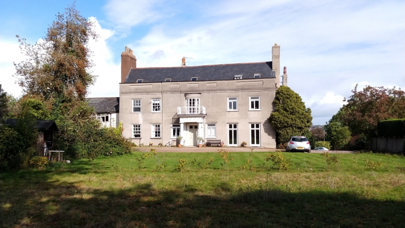
COWICK LANE 1. 1092 (South Side) The Villa SX 9190 16/778 II 2. Late C18. Backs onto road. Large detached house much altered. Attractive 2 storeys, 5 window stucco garden front with Greek Doric porch and iron balustrade and bowed window over. Some sash windows and some casements with fancy glazing bars. Doorway on north side has C18 hood on elaborate carved brackets. Panelled parapet, slate roof.
Listing NGR: SX9133990616
External links are from the relevant listing authority and, where applicable, Wikidata. Wikidata IDs may be related buildings as well as this specific building. If you want to add or update a link, you will need to do so by editing the Wikidata entry.


Other nearby listed buildings