Latitude: 53.6472 / 53°38'49"N
Longitude: -0.2188 / 0°13'7"W
OS Eastings: 517834
OS Northings: 418214
OS Grid: TA178182
Mapcode National: GBR VVX8.FB
Mapcode Global: WHHHB.ML0C
Plus Code: 9C5XJQWJ+VF
Entry Name: Killingholme High Lighthouse
Listing Date: 17 October 1985
Grade: II
Source: Historic England
Source ID: 1103706
English Heritage Legacy ID: 165871
Also known as: Killingholme High Range Light
ID on this website: 101103706
Location: North Lincolnshire, DN40
County: North Lincolnshire
Civil Parish: South Killingholme
Traditional County: Lincolnshire
Lieutenancy Area (Ceremonial County): Lincolnshire
Church of England Parish: North and South Killingholme St Denys
Church of England Diocese: Lincoln
Tagged with: Lighthouse
HUMBERSIDE GLANFORD 5264
TA 11 NE SOUTH KILLINGHOLME TA 178 182
11/71 Killingholme High Lighthouse
GV II
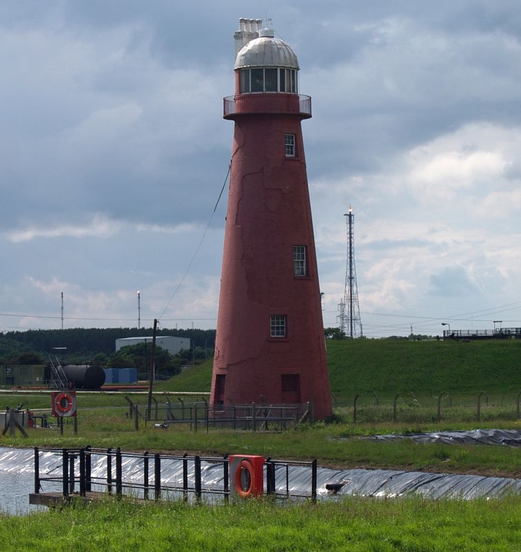
Lighthouse. Established 1831, rebuilt 1876-7 for Trinity House. Brick, rendered and colourwashed. 6-storey tapered round tower, 30 metres high. Recessed plain door under timber lintel. Two recessed louvred openings to ground floor, two or three 12-pane sashes to 2nd, 3rd, 4th and 5th floors with projecting cills and recessed lintels. Moulded cornice supports balcony to top floor with plain iron railings. Top floor has plinth, incised band below cillband, wide east-facing window with vertical glazing bars. Ribbed dome with scalloped eaves, capped with cylindrical ventilator and weathervane. Stack rising from south side has stepped cornice and four cylindrical pots. Plaque on north side inscribed: THIS LIGHT HOUSE WAS ENLARGED AND REBUILT BY THE TRINITY HOUSE OF KINGSTON UPON HULL 1877 JOHN WILSON (WARDENS GEORGE HARRISON ( THE ONE AT S.E. WAS ERECTED IN 1836 WILLM COLLINSON (WARDENS GEORGE NALL ( AND THE ONE AT THE N.E. IN 1851 JOHN SUGDEN (WARDENS HUNTER ESTILL (
Lighthouse, no longer manned, is used in conjunction with the nearby Killingholme South Low Lighthouse to guide shipping in the Humber, and in the C19 was a link in the Hull Telegraph. D. Jackson, Lighthouses of England and Wales, 1975, 104-5.
Listing NGR: TA1783418214
External links are from the relevant listing authority and, where applicable, Wikidata. Wikidata IDs may be related buildings as well as this specific building. If you want to add or update a link, you will need to do so by editing the Wikidata entry.


Other nearby listed buildings