Latitude: 53.5583 / 53°33'29"N
Longitude: -0.0248 / 0°1'29"W
OS Eastings: 530931
OS Northings: 408662
OS Grid: TA309086
Mapcode National: GBR XW89.F6
Mapcode Global: WHHHT.LTDK
Plus Code: 9C5XHX5G+83
Entry Name: Ross Castle
Listing Date: 17 September 1980
Last Amended: 22 December 1988
Grade: II
Source: Historic England
Source ID: 1103476
English Heritage Legacy ID: 164448
ID on this website: 101103476
Location: Pier Gardens, Cleethorpes, North East Lincolnshire, DN35
County: North East Lincolnshire
Electoral Ward/Division: Croft Baker
Parish: Non Civil Parish
Built-Up Area: Cleethorpes
Traditional County: Lincolnshire
Lieutenancy Area (Ceremonial County): Lincolnshire
Church of England Parish: Cleethorpes St Peter
Church of England Diocese: Lincoln
Tagged with: Folly
TA 3008 NE CLEETHORPES CENTRAL PROMENADE (west side)
8/8 Ross Castle 17/9/80 (formerly listed under Promenade)
GV II
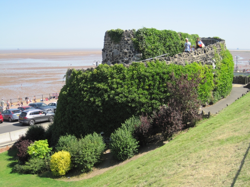
Castle Folly. 1885 for the Manchester, Sheffield and Lincolnshire Railway Company. Iron slag and limestone rubble. Built into the low sea cliff. Oval on plan, approximately 40 metres long by 25 metres wide, and approximately 10 metres high. 2 stages, the larger bottom stage, with low buttresses on the seaward side, carrying a path winding up to the top of the upper stage which has a wide arched recess on its south-west side and an irregular parapet above. Built as part of the improvements to the promenade and pier gardens undertaken by the railway company, and named after the company's secretary, Edward Ross. The top of the castle marks the original height of the clay cliffs which were being eroded by the sea until the new promenade was created. G Parratt and A J Kay, Cleethorpes Trail, 1987 p 5.
Listing NGR: TA3093108662
External links are from the relevant listing authority and, where applicable, Wikidata. Wikidata IDs may be related buildings as well as this specific building. If you want to add or update a link, you will need to do so by editing the Wikidata entry.


Other nearby listed buildings