Latitude: 51.7838 / 51°47'1"N
Longitude: 0.0964 / 0°5'47"E
OS Eastings: 544706
OS Northings: 211536
OS Grid: TL447115
Mapcode National: GBR LDH.178
Mapcode Global: VHHM6.MFBD
Plus Code: 9F32Q3MW+GH
Entry Name: 46, Burntmill Lane
Listing Date: 19 September 1984
Grade: II
Source: Historic England
Source ID: 1101272
English Heritage Legacy ID: 159897
ID on this website: 101101272
Location: Gilston, East Hertfordshire, CM20
County: Hertfordshire
District: East Hertfordshire
Civil Parish: Gilston
Traditional County: Hertfordshire
Lieutenancy Area (Ceremonial County): Hertfordshire
Church of England Parish: Gilston with Eastwick
Church of England Diocese: St.Albans
Tagged with: Building
TL 41 SW GILSTON BURNTMILL LANE (east side)
2/31 No 46
-
- II
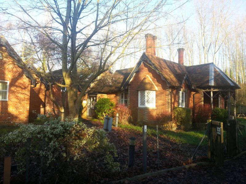
Lodge, now a house. Early C19. Single storey cottage ornee of bricks and tile facing S. T-plan with octagonal raised porch projection, the front part supported on 4 branching tree trunks, in middle of S front. Red brick with grey brick dressings to angles, arches and openings. Steep old red tile gabled roofs with wavy pierced bargeboards to E and W gables, 3-centred head to battened door in porch. 1 window each side, surmounted by segmental arch and small gable. On W wall, a 3-sided bay window with cast iron diamond lattice and steep tiled polygonal roof. Gabled rear wing. 2 tall octagonal red brick chimneys with spurred caps and moulded bases. Linked to parallel roofed red brick tiled outbuilding at NW with twin bargeboarded gables with chimney between, at S end. Formerly the South Lodge to Terlings, a country house now demolished. A picturesque lodge in the form of a single storey cottage ornee.
Listing NGR: TL4470611536
External links are from the relevant listing authority and, where applicable, Wikidata. Wikidata IDs may be related buildings as well as this specific building. If you want to add or update a link, you will need to do so by editing the Wikidata entry.


Other nearby listed buildings