Latitude: 52.3673 / 52°22'2"N
Longitude: -2.1804 / 2°10'49"W
OS Eastings: 387815
OS Northings: 274380
OS Grid: SO878743
Mapcode National: GBR 1D2.FLJ
Mapcode Global: VH91W.5R5K
Plus Code: 9C4V9R89+WV
Entry Name: Priest's House
Listing Date: 18 March 1987
Grade: II
Source: Historic England
Source ID: 1100675
English Heritage Legacy ID: 157021
ID on this website: 101100675
Location: St Mary's Roman Catholic Chapel, Harvington, Wyre Forest, Worcestershire, DY10
County: Worcestershire
District: Wyre Forest
Civil Parish: Chaddesley Corbett
Traditional County: Worcestershire
Lieutenancy Area (Ceremonial County): Worcestershire
Church of England Parish: Kidderminster East
Church of England Diocese: Worcester
Tagged with: House
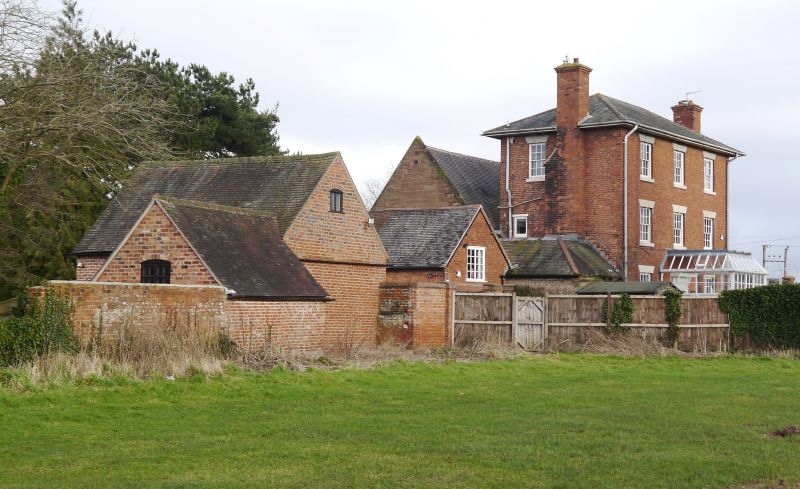
CHADDESLEY CORBETT CP HARVINGTON SO 87 SE 10/34 Priest's House GV II House. 1838 with some late C19 alterations. Brick with hipped slate roof. Three storeys, boarded eaves, three windows: 16-pane sashes under plastered wedge lintels. Second floor as first floor. Ground floor with pilastered wooden doorcase with flat canopy enclosed with C19 glazed conservatory. (Hodgkinson, H R: "Further Notes on Harvington Hall", Transactions of the Birmingham and Warwickshire Archaeological Society, Vol 73 for 1955 (1957), pp 98-9).
Listing NGR: SO8782074384
External links are from the relevant listing authority and, where applicable, Wikidata. Wikidata IDs may be related buildings as well as this specific building. If you want to add or update a link, you will need to do so by editing the Wikidata entry.


Other nearby listed buildings