Latitude: 54.1709 / 54°10'15"N
Longitude: -2.9463 / 2°56'46"W
OS Eastings: 338318
OS Northings: 475420
OS Grid: SD383754
Mapcode National: GBR 7NV6.XM
Mapcode Global: WH83K.QF5D
Plus Code: 9C6V53C3+8F
Entry Name: Wraysholme Tower
Listing Date: 25 March 1970
Grade: II*
Source: Historic England
Source ID: 1100320
English Heritage Legacy ID: 77025
ID on this website: 101100320
Location: Westmorland and Furness, Cumbria, LA11
County: Westmorland and Furness
District: South Lakeland
Civil Parish: Lower Allithwaite
Traditional County: Lancashire
Lieutenancy Area (Ceremonial County): Cumbria
Church of England Parish: Allithwaite St Mary
Church of England Diocese: Carlisle
Tagged with: Tower house
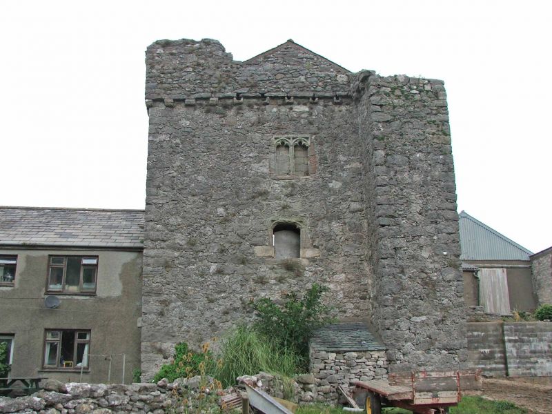
LOWER ALLITHWAITE WRAYSHOLME LANE SD 37 NE (East side) Flookburgh 5/111 Wraysholme Tower 25.3.70 II* Peel tower, now barn over cowhouse. Probably late C15. Dressed stone with slate roof. Square tower, originally of 3 storeys, 1st floor now rises to gabled roof. North elevation has corbelled parapet, some corbels pierced to form water spouts, and angle turrets with corbelled embattled parapets, both damaged to south side. Large C20 building attached, and 2nd floor flat-headed window of 2 cusped lights. East elevation has entrance with rough head and small window to right, probably both inserted. 1st floor has hollow chamfered light, and large inserted entrance, approached by ramp and bridge, to north end. 2nd floor has 2 hollow-chamfered lights. South elevation has projecting garderobe to east end, rising to full height, the turret now missing, but with traces of corralling to returns; small lights to west return. Ground floor has chamfered light and lean-to privy next to garderobe turret; 1st floor has flat-headed window, originally of 2 cusped lights but mullion missing; 2nd floor has flat-headed window of 2 cusped lights; corbelled parapet and gable, remains of turret to west angle. West facade has attached farmhouse (datestones of C17 and C19, much altered). Stair lights to south end. Pointed entrance to north end has hollow chamfered opening and jamb missing; hollow chamfered light to each floor above. Pointed entrance, now leading to house opens onto lobby, with spiral stair in south-west angle; pointed entrance to main space. Ground floor has cowhouse partitions. Stair has straight-headed entrance with hollow chamfered reveals to each floor; Tudor-headed fireplace to each floor, that to ground floor now window. A good example of peel tower unaltered by post-medieval domestic use. A Scheduled Ancient Monument.
Listing NGR: SD3831875420
External links are from the relevant listing authority and, where applicable, Wikidata. Wikidata IDs may be related buildings as well as this specific building. If you want to add or update a link, you will need to do so by editing the Wikidata entry.


Other nearby listed buildings