Latitude: 52.3876 / 52°23'15"N
Longitude: -2.2647 / 2°15'52"W
OS Eastings: 382082
OS Northings: 276647
OS Grid: SO820766
Mapcode National: GBR 0BF.B87
Mapcode Global: VH91T.P8M1
Plus Code: 9C4V9PQP+24
Entry Name: The Grove
Listing Date: 17 January 1980
Grade: II
Source: Historic England
Source ID: 1100074
English Heritage Legacy ID: 156412
ID on this website: 101100074
Location: Blakebrook, Wyre Forest, Worcestershire, DY11
County: Worcestershire
District: Wyre Forest
Civil Parish: Kidderminster
Built-Up Area: Kidderminster
Traditional County: Worcestershire
Lieutenancy Area (Ceremonial County): Worcestershire
Church of England Parish: Kidderminster St John the Baptist and Holy Innocents
Church of England Diocese: Worcester
Tagged with: Building
This list entry was subject to a Minor Amendment on 25 November 2025 to amend the name and address and reformat the text to current standards
SO 8276 1/65
BLAKEBROOK (west side)
No 8, The Grove
(Formerly listed as Flats 1 to 6 (consec), No 8 (The Limes)
GV
II
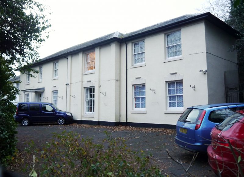
Early-mid C19. Two storeys, rough rendered with hipped slate roof. Four windows of irregular size above three to ground floor, stepped rusticated lintels with keystones. Porch with narrow columns, modern door. Window to gable end has four plain pilasters. Included for group value.
Listing NGR: SO8208276647
External links are from the relevant listing authority and, where applicable, Wikidata. Wikidata IDs may be related buildings as well as this specific building. If you want to add or update a link, you will need to do so by editing the Wikidata entry.


Other nearby listed buildings