Latitude: 52.3735 / 52°22'24"N
Longitude: -2.3138 / 2°18'49"W
OS Eastings: 378732
OS Northings: 275098
OS Grid: SO787750
Mapcode National: GBR 0BK.3V6
Mapcode Global: VH91S.VL4T
Plus Code: 9C4V9MFP+CF
Entry Name: 1-5 Cookes Almshouses
Listing Date: 22 April 1950
Grade: II
Source: Historic England
Source ID: 1099987
English Heritage Legacy ID: 156705
ID on this website: 101099987
Location: Bewdley, Wyre Forest, Worcestershire, DY12
County: Worcestershire
District: Wyre Forest
Civil Parish: Bewdley
Built-Up Area: Bewdley
Traditional County: Worcestershire
Lieutenancy Area (Ceremonial County): Worcestershire
Church of England Parish: Ribbesford with Bewdley and Dowles etc
Church of England Diocese: Worcester
Tagged with: Almshouse
This list entry was subject to a Minor Amendment on 21 June 2024 to amend the name and address and reformat the text to current standards
SO 7875 SE
13/63
BEWDLEY CP
HIGH STREET (south side)
Cooke's Almshouses
Nos 1-5
(Formerly listed as Cooke's Almshouses Nos 1 - 8 (consec))
22.4.50
GV
II
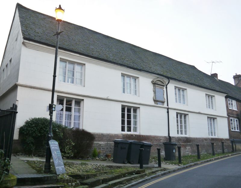
Eight almshouses. Founded 1693, restored 1860, with some mid-C20 alterations. Rendered sandstone and brick with tile roof, stacks in two clusters of four square shafts to rear. Two storeys, moulded cornice, string to ground floor, C19 brick plinth; four windows: Three-light casements; centrally placed stone tablet bearing long inscription concerning the founder, Thomas Cooke, has a segmental pediment and eared architrave with consoles. To rear a lean-to along whole wall which contains the entrance. (BoE, p 86; VCH 4, p 299 - 300, 316).
Listing NGR: SO7861875253
External links are from the relevant listing authority and, where applicable, Wikidata. Wikidata IDs may be related buildings as well as this specific building. If you want to add or update a link, you will need to do so by editing the Wikidata entry.


Other nearby listed buildings