Latitude: 54.2981 / 54°17'53"N
Longitude: -0.7033 / 0°42'11"W
OS Eastings: 484488
OS Northings: 489945
OS Grid: SE844899
Mapcode National: GBR RLJR.J0
Mapcode Global: WHGBW.57C9
Plus Code: 9C6X77XW+7M
Entry Name: Cherry Tree Farmhouse
Listing Date: 5 February 1986
Grade: II
Source: Historic England
Source ID: 1096961
English Heritage Legacy ID: 439665
ID on this website: 101096961
Location: Lockton, North Yorkshire, YO18
County: North Yorkshire
District: Ryedale
Civil Parish: Lockton
Traditional County: Yorkshire
Lieutenancy Area (Ceremonial County): North Yorkshire
Church of England Parish: Lockton St Giles
Church of England Diocese: York
Tagged with: Farmhouse
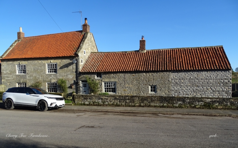
LOCKTON VILLAGE STREET SE 88 NW (north-east side) 6/72 Cherry Tree Farmhouse GV II Farmhouse. Mid C18 of two builds, with later alteration. Coursed squared sandstone; pantile roof; brick stacks. 3-cell hearth-passage plan with rear service wing. 2-storey, 2-window high end to left and 1½ storey single window low end to right. C20 half-glazed door beneath overlight to left of low end. Squat 20-pane sash and heavy plain lintel to right; small pivoting window with glazing bars at end right, and to attic. 20-pane sashes with raised keyblock lintels to high end, and stepped eaves course. Left gable wall: small 2-light casement in chamfered mullion surround. Rear: continuous outshut to low end has 2-light, small-pane horizontal sliding sashes. Coped gables, shaped kneelers and end stacks to high end; centre right stack to low end.
Listing NGR: SE8448889945
External links are from the relevant listing authority and, where applicable, Wikidata. Wikidata IDs may be related buildings as well as this specific building. If you want to add or update a link, you will need to do so by editing the Wikidata entry.


Other nearby listed buildings