Latitude: 52.2428 / 52°14'34"N
Longitude: 0.7129 / 0°42'46"E
OS Eastings: 585320
OS Northings: 263982
OS Grid: TL853639
Mapcode National: GBR QF0.734
Mapcode Global: VHKD4.9WRJ
Plus Code: 9F426PV7+45
Entry Name: 67, Whiting Street
Listing Date: 7 August 1952
Grade: II
Source: Historic England
Source ID: 1096709
English Heritage Legacy ID: 467814
ID on this website: 101096709
Location: Bury St Edmunds, West Suffolk, IP33
County: Suffolk
District: West Suffolk
Civil Parish: Bury St Edmunds
Built-Up Area: Bury St Edmunds
Traditional County: Suffolk
Lieutenancy Area (Ceremonial County): Suffolk
Church of England Parish: Bury St Edmunds St Mary
Church of England Diocese: St.Edmundsbury and Ipswich
Tagged with: Building
BURY ST EDMUNDS
TL8563NW WHITING STREET 639-1/15/721 (West side) 07/08/52 No.67
GV II
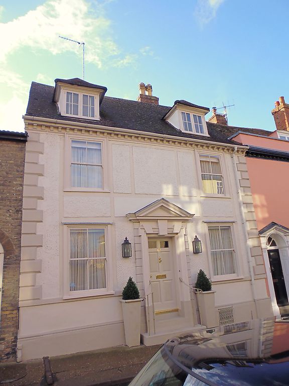
House. C16 and C18. Timber-framed and rendered in roughcast panels. Plaintiled roof with modillion eaves cornice. EXTERIOR: 2 storeys and cellar; attic to front range. 2 window range: sashes with a single vertical glazing bar in flush cased frames to each storey. 2 hipped dormers with 2-light 4-paned casement windows. Central entrance door up steps with a Gibbs style surround to the doorcase surmounted by a triangular pediment. Plain reveals. 6-panel door with the top 2 panels glazed. An internal chimney-stack links the front with a 2-storey rear wing: this has two 12-pane sash windows to the south side of the ground storey with heavy ovolo-moulded glazing-bars in flush cased frames, and 2 old 2-light 4-pane casement windows to the 1st storey. An end chimney-stack. INTERIOR: a brick lined cellar with some stone blocks and the remains of an original timber ceiling. Plain early C18 front range. The rear wing is in 2 bays, formerly divided into 2 heated rooms, but now made into one, with the infilling between the studs in the partition wall removed, revealing very heavy studding. One fireplace has a plain timber lintel, the other a bolection-moulded surround. On the upper storey, the main timbers are exposed: cambered tie-beams, rebates for shutters in both wallplates; roof covered. The front range has an attic roof in 5 bays, with clasped purlins and straight collars, but rafters covered.
Listing NGR: TL8532063982
External links are from the relevant listing authority and, where applicable, Wikidata. Wikidata IDs may be related buildings as well as this specific building. If you want to add or update a link, you will need to do so by editing the Wikidata entry.


Other nearby listed buildings