Latitude: 52.7681 / 52°46'5"N
Longitude: -1.4824 / 1°28'56"W
OS Eastings: 435019
OS Northings: 319075
OS Grid: SK350190
Mapcode National: GBR 6GS.J1F
Mapcode Global: WHDHL.6PC7
Plus Code: 9C4WQG99+72
Entry Name: Ivanhoe House
Listing Date: 6 January 1987
Grade: II
Source: Historic England
Source ID: 1096469
English Heritage Legacy ID: 82878
ID on this website: 101096469
Location: Smisby, South Derbyshire, LE65
County: Derbyshire
District: South Derbyshire
Civil Parish: Smisby
Traditional County: Derbyshire
Lieutenancy Area (Ceremonial County): Derbyshire
Church of England Parish: Smisby St James
Church of England Diocese: Derby
Tagged with: House
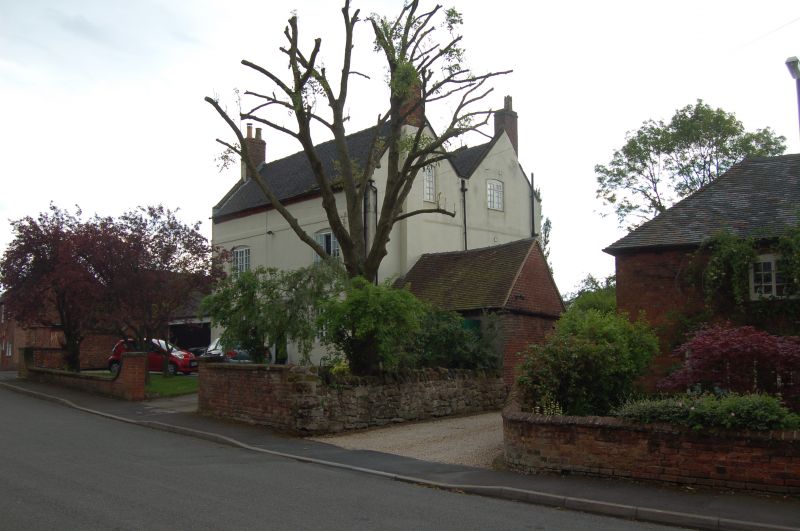
PARISH OF SMISBY MAIN STREET SK 31 NE 7/72 (South Side) Ivanhoe House GV II House. Early C18. Rendered brick, plain tile roof with brick external gable stacks and stone coped gables with plain kneelers. Plain first and second floor bands and dentil eaves cornice. Two storeys. Symmetrical two-bay north elevation has two steps up to central doorway with wooden surround and flat hood. Panelled door. Flanked on each side by 3-light segment headed casement windows. Two similar windows above. All the windows have C20 louvred shutters. The rear elevation has four 3-light segment headed Yorkshire sashes, a doorway with half glazed door, and a tall staircase window. Interior has dogleg staircase with splat balusters.
Listing NGR: SK3501919075
External links are from the relevant listing authority and, where applicable, Wikidata. Wikidata IDs may be related buildings as well as this specific building. If you want to add or update a link, you will need to do so by editing the Wikidata entry.


Other nearby listed buildings