Latitude: 52.1997 / 52°11'58"N
Longitude: -2.1774 / 2°10'38"W
OS Eastings: 387974
OS Northings: 255734
OS Grid: SO879557
Mapcode National: GBR 1G6.2B6
Mapcode Global: VH92N.6ZS2
Plus Code: 9C4V5RXF+V3
Entry Name: Lyppard Grange
Listing Date: 29 December 1952
Last Amended: 26 November 1986
Grade: II
Source: Historic England
Source ID: 1095987
English Heritage Legacy ID: 147301
ID on this website: 101095987
Location: Warndon, Worcester, Worcestershire, WR4
County: Worcestershire
District: Worcester
Civil Parish: Warndon
Built-Up Area: Worcester
Traditional County: Worcestershire
Lieutenancy Area (Ceremonial County): Worcestershire
Church of England Parish: Warndon St Nicholas
Church of England Diocese: Worcester
Tagged with: Building
WARNDON - SO 85 NE 22/1 Lyppard Grange (formerly listed as Leopard Grange) 29.12.52 GV II
SO 85 NE WARNDON - 2/609 Lyppard Grange (formerly listed as Leopard Grange) 29.12.52 GV II
------------------------------------
WARNDON CP - SO 85 NE 22/1 Lyppard Grange (previously listed as 29.12.52 Leopard Grange)
GV II
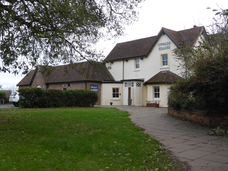
Shown on the OS Map as Leopard Grange. House. Early C17 with alterations of 1705 and early to mid-C19. Timber- frame clad in rendered brick with brick extensions, tile roof. Three framed bays of early C17 aligned north/south, extended in 1705 by similar sized block to east in brick with lower service wing extending east attached at north-east corner; stack at junction with rear wing, and in centre of three frame bays, the latter with three shafts of 6-pointed star plan. West front: two storeys with attic lit by three windows in gables (that to right collapsed); three windows with stone sills, blocked with concrete blocks; ground floor: central entrance under lean-to canopy supported by two flanking angled bay windows. North front has exposed brickwork of 1705 with two bands and chequer effect to brickwork produced by blue headers; a first floor window has a keystone with moulded brick head which formerly bore the inscription: "1705/ W [illegible letter] M". There are traces of a moat around the house. The building was empty and in a state of decay at the time of the survey (November 1984). (VCH 3, pp 510-511).
Listing NGR: SO8803655905
External links are from the relevant listing authority and, where applicable, Wikidata. Wikidata IDs may be related buildings as well as this specific building. If you want to add or update a link, you will need to do so by editing the Wikidata entry.


Other nearby listed buildings