Latitude: 51.0277 / 51°1'39"N
Longitude: -1.3927 / 1°23'33"W
OS Eastings: 442683
OS Northings: 125550
OS Grid: SU426255
Mapcode National: GBR 86B.GQJ
Mapcode Global: FRA 76ZD.F8H
Plus Code: 9C3W2JH4+3W
Entry Name: Wilsons the Grocers
Listing Date: 27 November 1984
Grade: II
Source: Historic England
Source ID: 1095796
English Heritage Legacy ID: 145801
ID on this website: 101095796
Location: Hursley, Winchester, Hampshire, SO21
County: Hampshire
District: Winchester
Civil Parish: Hursley
Built-Up Area: Hursley
Traditional County: Hampshire
Lieutenancy Area (Ceremonial County): Hampshire
Church of England Parish: Hursley All Saints
Church of England Diocese: Winchester
Tagged with: Building
SU 4225 HURSLEY A3090 (West Side)
10/5 31,(Wilsons the Grocers)
II
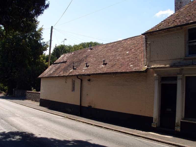
House and added shop and stable block. C18 house with C19 shop and stable. Colourwashed header bond brick, old plain tile roof. 3 bay, 2 storey house with 2 bays added to left for shop and 3 bay single storey stable. Original house has C18 6-panel door and rectangular fanlight in architrave with panelled reveal and moulded cornice. 5 4-pane sashes with rubbed brick arches. To left on ground floor early C19 shop front of door copying other at left and cornice continuing over 3-pane large shop window to pilaster at right. A similar 4-pane sash above. Dentilled cornice interrupted by heads of sashes. Hipped roof with end stacks. Stable block blank except for single cast iron lozenge-pane casement.
Listing NGR: SP4520327957
External links are from the relevant listing authority and, where applicable, Wikidata. Wikidata IDs may be related buildings as well as this specific building. If you want to add or update a link, you will need to do so by editing the Wikidata entry.


Other nearby listed buildings