Latitude: 51.0829 / 51°4'58"N
Longitude: -1.0782 / 1°4'41"W
OS Eastings: 464662
OS Northings: 131911
OS Grid: SU646319
Mapcode National: GBR B8T.46S
Mapcode Global: FRA 86M8.9R3
Plus Code: 9C3W3WMC+5P
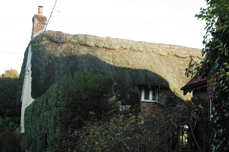
Entry Name: Cromwell Cottage
Listing Date: 11 October 1985
Grade: II
Source: Historic England
Source ID: 1093930
English Heritage Legacy ID: 142384
ID on this website: 101093930
Location: Ropley, East Hampshire, SO24
County: Hampshire
District: East Hampshire
Civil Parish: Ropley
Built-Up Area: Ropley
Traditional County: Hampshire
Lieutenancy Area (Ceremonial County): Hampshire
Church of England Parish: Ropley St Peter
Church of England Diocese: Winchester
Tagged with: Cottage Thatched cottage
SU 63 SW ROPLEY CHURCH STREET
3/25 Cromwell Cottage GV II 2 cottages, now one. C17, C18, with C20 restoration. Rendered walls, the rear (west) having partly-exposed timber-framing with brick infill above flint walling. Thatched roof, ½-hipped at the south end (at an angle), eyebrow dormers The east front is one storey and attic, 4 windows. C20 casements and plain doorways.
Listing NGR: SU6466231913
External links are from the relevant listing authority and, where applicable, Wikidata. Wikidata IDs may be related buildings as well as this specific building. If you want to add or update a link, you will need to do so by editing the Wikidata entry.


Other nearby listed buildings