Latitude: 51.2066 / 51°12'23"N
Longitude: -1.4764 / 1°28'35"W
OS Eastings: 436674
OS Northings: 145399
OS Grid: SU366453
Mapcode National: GBR 72R.CJY
Mapcode Global: VHC2S.CXBW
Plus Code: 9C3W6G4F+MC
Entry Name: Clare House
Listing Date: 24 June 1983
Grade: II
Source: Historic England
Source ID: 1093494
English Heritage Legacy ID: 139489
ID on this website: 101093494
Location: Andover, Test Valley, Hampshire, SP10
County: Hampshire
District: Test Valley
Civil Parish: Andover
Built-Up Area: Andover
Traditional County: Hampshire
Lieutenancy Area (Ceremonial County): Hampshire
Church of England Parish: Andover St Mary
Church of England Diocese: Winchester
Tagged with: House
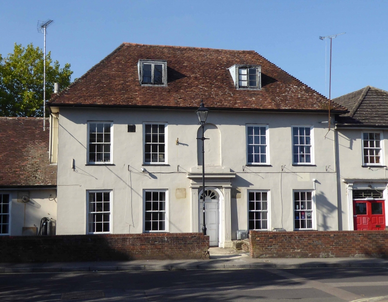
SU 3645 SE ANDOVER EAST STREET 4/31 Clare House II C18. Symmetrical facade (east) of 2 storeys and attic, 5 windows. Steep hipped tile roof, 2 modern flat-roofed dormers. Stucco walling, plinth, arched panel above the central doorway. Sashes in exposed frames. The doorway has a simple order, with pilasters, an arched opening with a radiating fanlight and 6-panelled door. There are later extensions.
Listing NGR: SU3666845407
External links are from the relevant listing authority and, where applicable, Wikidata. Wikidata IDs may be related buildings as well as this specific building. If you want to add or update a link, you will need to do so by editing the Wikidata entry.


Other nearby listed buildings