Latitude: 52.0068 / 52°0'24"N
Longitude: -1.9019 / 1°54'6"W
OS Eastings: 406830
OS Northings: 234267
OS Grid: SP068342
Mapcode National: GBR 3MK.00V
Mapcode Global: VHB16.ZTDG
Plus Code: 9C4W234X+P6
Entry Name: 1-4, High Street
Listing Date: 4 July 1960
Last Amended: 7 September 1987
Grade: II
Source: Historic England
Source ID: 1091831
English Heritage Legacy ID: 134853
ID on this website: 101091831
Location: Stanton, Tewkesbury, Gloucestershire, WR12
County: Gloucestershire
District: Tewkesbury
Civil Parish: Stanton
Built-Up Area: Stanton
Traditional County: Gloucestershire
Lieutenancy Area (Ceremonial County): Gloucestershire
Church of England Parish: Stanton and Snowshill
Church of England Diocese: Gloucester
Tagged with: Building
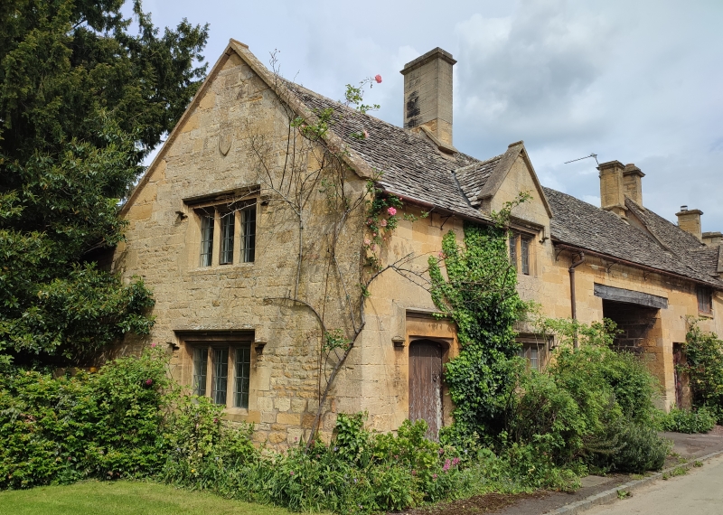
STANTON HIGH STREET SP 0634-0734 (north side) 11/70 Nos 1 - 4 (consecutive) (previously partly listed as 4.7.60 Nos 2 - 4 consecutive) GV II Terrace of 4 cottages, in 2 sections. Possibly late C17, early C20. Well-squared, coursed stone to Nos 1 and 2, roughly-squared, coursed stone Nos 3 and 4, stone slate roof. Long U plan, 6-unit wide front, wide archway second bay on left, 2 rooms deep, except bays 2 and 3, 1 1/2 storeys. On left, boarded door, Tudor arch, hoodmould: 3-light mullioned window, hoodmould. Above 2-light mullion window with hoodmould, in gabled dormer with parapet. Wide archway, timber lintel just below eaves. Half-glazed door up brick step, deep stone lintel: 3-light mullioned window, 3-light casement over. Parapet gable left end, ridge chimney to left of archway, and at right end. To right, ground floor 3-light mullioned window, hoodmould; half-glazed door up one stone step, deep stone lintel. Three-light mullioned window with hoodmould, boarded door up 2 stone steps, timber lintel. Above wall carried up into dormers, 2-light mullioned windows, left with hoodmould and parapet gable, right moulded string course, hipped roof. To right, 3-light mullioned window, 2-light above, both with hoodmoulds, parapet gable, roll ridge. Roof higher than in Nos 1 and 2; ridge chimneys centre and right end. On right further, plain gable, with parapet, arched recess at foot for water tap, chamfered arris on right running out top and bottom.
Listing NGR: SP0683034267
External links are from the relevant listing authority and, where applicable, Wikidata. Wikidata IDs may be related buildings as well as this specific building. If you want to add or update a link, you will need to do so by editing the Wikidata entry.


Other nearby listed buildings