Latitude: 51.9768 / 51°58'36"N
Longitude: -1.9428 / 1°56'34"W
OS Eastings: 404026
OS Northings: 230929
OS Grid: SP040309
Mapcode National: GBR 3MW.1MW
Mapcode Global: VHB1D.8KSY
Plus Code: 9C3WX3G4+PV
Entry Name: Millhampost Farmhouse
Listing Date: 4 July 1960
Last Amended: 7 September 1987
Grade: II
Source: Historic England
Source ID: 1091802
English Heritage Legacy ID: 134884
ID on this website: 101091802
Location: Tewkesbury, Gloucestershire, GL54
County: Gloucestershire
District: Tewkesbury
Civil Parish: Stanway
Traditional County: Gloucestershire
Lieutenancy Area (Ceremonial County): Gloucestershire
Church of England Parish: Toddington, Stanway and Didbrook and Hailes
Church of England Diocese: Gloucester
Tagged with: Farmhouse
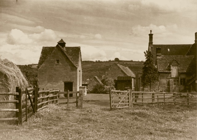
STANWAY A46 SP 03 SW (west side) 3/98 Millhampost Farmhouse (formerly listed as part of 4.7.60 Millhampost Farmhouse and Dovecote) GV II Farmhouse. C17, altered probably C18, C19, C20. Coursed, squared stone, timber-framing with rendered panels, rough-render to one wall, tiled roof. 'L' plan, 4 x 2, two storeys, with single-storey infill to rear. South, garden front: stone at left end, narrow band up right corner, render over stone plinth between (probably on brick or stone). Four mid C20 three-light metal casements to each floor: hipped roof, ridge chimney to right of centre. Right return stone, two 3-light mullioned windows each floor, lower with hoodmoulds. Parapet gable on right end, ridge chimney. Rear wall to long range timber-framed; low, timber-framed wing off left end at rear: infill C20. Forms group with dovecote (q.v.). Interior not inspected.
Listing NGR: SP0402630929
External links are from the relevant listing authority and, where applicable, Wikidata. Wikidata IDs may be related buildings as well as this specific building. If you want to add or update a link, you will need to do so by editing the Wikidata entry.


Other nearby listed buildings