Latitude: 51.9987 / 51°59'55"N
Longitude: -2.0024 / 2°0'8"W
OS Eastings: 399934
OS Northings: 233364
OS Grid: SO999333
Mapcode National: GBR 2L2.QKY
Mapcode Global: VHB1C.71S3
Plus Code: 9C3VXXXX+F3
Entry Name: Gardener's Arms
Listing Date: 4 July 1960
Grade: II
Source: Historic England
Source ID: 1091729
English Heritage Legacy ID: 135104
ID on this website: 101091729
Location: Alderton, Tewkesbury, Gloucestershire, GL20
County: Gloucestershire
District: Tewkesbury
Civil Parish: Alderton
Built-Up Area: Alderton
Traditional County: Gloucestershire
Lieutenancy Area (Ceremonial County): Gloucestershire
Church of England Parish: Alderton St Margaret of Antioch
Church of England Diocese: Gloucester
SP 9933 ALDERTON BECKFORD ROAD (south side)
12/7 Gardener's Arms
4.7.60
GV II
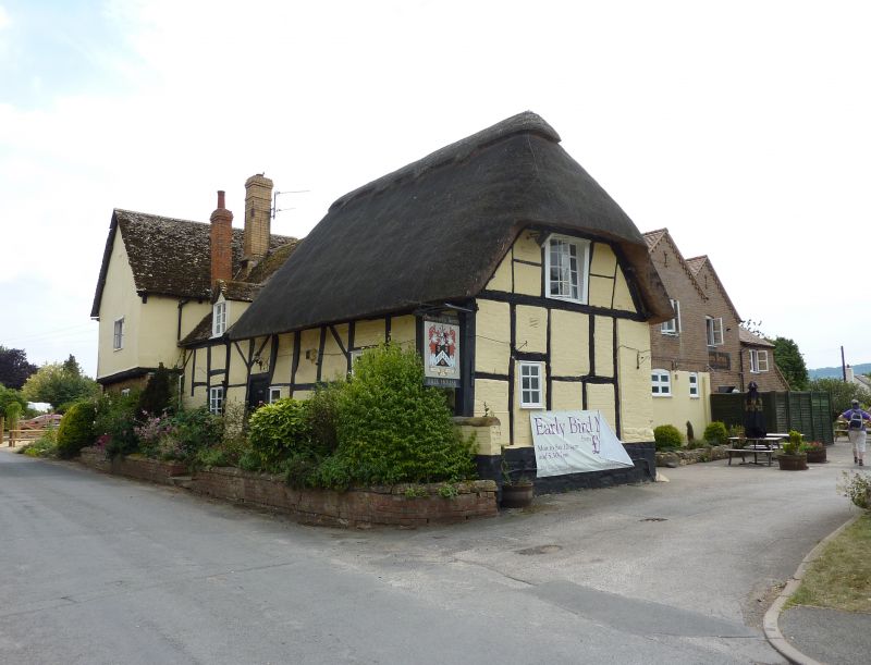
Inn. Early-mid C17. Square-panelled timber framing with rendered and painted brick infill on a stone plinth; part thatch, part stone slate roof. Cross wing with large blocks of coursed squared and dressed limestone, jettied first floor possibly close-studded timber framing now rendered; stone slate roofing; brick stacks, one on an ashlar stump. 1½ - 2 storeys. Roadside front with the jettied range projecting forwards to left; 3-light wooden casement and plank door to the ground floor of this gable; similar 3-light casement to the first floor. Blocked window with a stone surround to the left-hand return. Irregular fenestration to the range to the right: one single-light C20 casement with horizontal glazing bars, one 2-light casement with horizontal glazing bars; one top- opening casement. C20 two-light eaves dormer to the slated part of the roof. Central C20 plank door. Right gable end: single C20 top-opening casement to the ground floor; C20 two-light casement to the first floor with a half-hipped gable above. Off-the-ridge stacks. Interior: spine beam within the east - west range.
Listing NGR: SO9993433364
External links are from the relevant listing authority and, where applicable, Wikidata. Wikidata IDs may be related buildings as well as this specific building. If you want to add or update a link, you will need to do so by editing the Wikidata entry.


Other nearby listed buildings