Latitude: 51.7271 / 51°43'37"N
Longitude: -2.3123 / 2°18'44"W
OS Eastings: 378526
OS Northings: 203204
OS Grid: SO785032
Mapcode National: GBR 0L9.Q72
Mapcode Global: VH94W.VVYB
Plus Code: 9C3VPMGQ+V3
Entry Name: Royal Gloucestershire Hussars
Listing Date: 24 March 1988
Grade: II
Source: Historic England
Source ID: 1091168
English Heritage Legacy ID: 132901
ID on this website: 101091168
Location: Frocester, Stroud, Gloucestershire, GL10
County: Gloucestershire
District: Stroud
Civil Parish: Frocester
Traditional County: Gloucestershire
Lieutenancy Area (Ceremonial County): Gloucestershire
Church of England Parish: Frocester St Andrew
Church of England Diocese: Gloucester
Tagged with: Building
SO 7803 FROCESTER BATH ROAD (west side)
9/107 Royal Gloucestershire Hussars
II
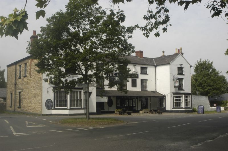
Former coaching inn, now hotel. Part Cl8, mostly rebuilt c1820. Random rubble limestone, mostly smooth rendered; brick chimneys; Welsh slate roof. Three-storey with 2 projecting front wings. East front: 3-window fenestration to central part, large 16-pane sashes to ground and middle floors, 8-pane to upper floor. central glazed lobby entrance beneath continuous lean-to canopy with iron column supports. Each wing has large canted ground floor bay window with 16-pane sashes, left wing 2-storey with 16-pane upper floor sash, right 3-storey, fenestration as to main part of front. South side: exposed rubble masonry with scattered 12-pane sash fenestration. Eaves-mounted brick chimney. North side: 2 projecting chimney stacks, both with brick shafts. Single-storey outbuildings to rear incorporating former stables and coach house. Interior: stone vaulted cellar in rear wing. Some other C18 and Cl9 features. Stands on Gloucester-Bath turnpike, superceded by easier route constructed along Nailsworth valley. (N.M. Herbert, 'Frocester' in V.C.H. Glos. x, 1972, pp. 170-178, and Road Travel and Transport in Gloucestershire, 1985).
Listing NGR: SO7852603204
External links are from the relevant listing authority and, where applicable, Wikidata. Wikidata IDs may be related buildings as well as this specific building. If you want to add or update a link, you will need to do so by editing the Wikidata entry.


Other nearby listed buildings