Latitude: 51.7404 / 51°44'25"N
Longitude: -2.2718 / 2°16'18"W
OS Eastings: 381329
OS Northings: 204672
OS Grid: SO813046
Mapcode National: GBR 0L5.VWG
Mapcode Global: VH94X.KJV4
Plus Code: 9C3VPPRH+57
Entry Name: Ryeford House
Listing Date: 24 February 1987
Grade: II
Source: Historic England
Source ID: 1090663
English Heritage Legacy ID: 132067
ID on this website: 101090663
Location: Ryeford, Stroud, Gloucestershire, GL10
County: Gloucestershire
District: Stroud
Civil Parish: Stonehouse
Built-Up Area: Stroud
Traditional County: Gloucestershire
Lieutenancy Area (Ceremonial County): Gloucestershire
Church of England Parish: Stonehouse St Cyr
Church of England Diocese: Gloucester
Tagged with: House
SO 8104 STONEHOUSE RYEFORD
10/192 Nos 1 and 2 Ryeford House
GV II
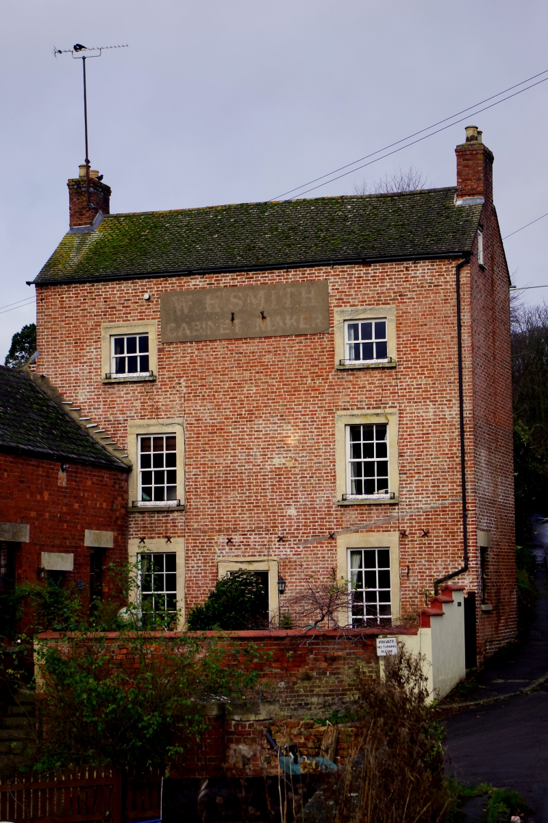
House at end of row with attached former warehouse, now No 2, Ryeford House. Late C18; early C19 warehouse. Flemish bond red brick, English bond to warehouse; brick chimneys; concrete plain tile roof, Welsh slate to No 2. Three-storey with attic; single- storey warehouse with attic and cellar. South front: 2-window fenestration, 12-pane sashes to ground and middle floors, 6-pane to attic, all with plain ashlar architraves. Off-centre doorway with plain architraves and C20 door. Central raised rendered panel to attic has remains of lettering: 'W. B. SMITH / CABINET MAKER'. Gable end chimneys. Rear: tall small-paned fixed-light with timber lintel at centre with two 12-pane sashes to right, all with timber lintels. Warehouse projects forward from left part of south front with bargeboards to gable end having plank double cellar doors with small-paned flanking casements, 12-pane sash to ground floor and attic, all with stone lintels. Doorway with C20 door on east side of warehouse with flanking 12-pane sashes. Forms part of group with Ryeford Bridge and Tankard House (q.v.). (M.A. Handford and D.J. Viner, Stroudwater and Thames and Severn Canals Towpath Guide, 1984.)
Listing NGR: SO8132904672
External links are from the relevant listing authority and, where applicable, Wikidata. Wikidata IDs may be related buildings as well as this specific building. If you want to add or update a link, you will need to do so by editing the Wikidata entry.


Other nearby listed buildings